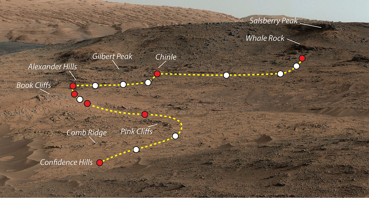
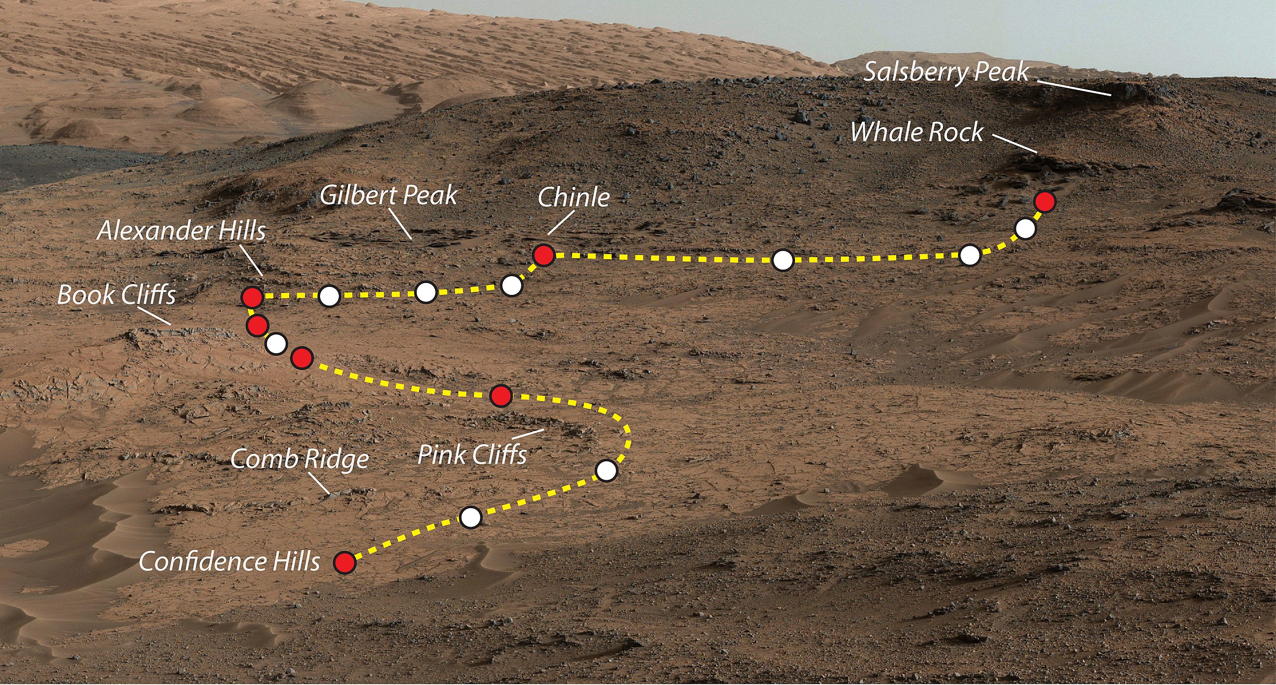
File:Pia19039 some key places in a survey of the "Pahrump Hills" .jpg
Jump to navigation
Jump to search

Size of this preview: 800 × 430 pixels. Other resolutions: 320 × 172 pixels | 640 × 344 pixels | 1,024 × 550 pixels | 1,280 × 687 pixels | 2,560 × 1,375 pixels | 4,067 × 2,184 pixels.
Original file (4,067 × 2,184 pixels, file size: 2.27 MB, MIME type: image/jpeg)
File history
Click on a date/time to view the file as it appeared at that time.
| Date/Time | Thumbnail | Dimensions | User | Comment | |
|---|---|---|---|---|---|
| current | 23:49, 4 November 2014 | | 4,067 × 2,184 (2.27 MB) | commons>Romkur | {{Information |Description=This view shows the path and some key places in a survey of the "Pahrump Hills" outcrop by NASA's Curiosity Mars rover in autumn of 2014. The outcrop is at the base of Mount Sharp within Gale Crater. Image Credit: NASA/JPL-C... |
File usage
There are no pages that use this file.