File:Philippine climate map.png
Jump to navigation
Jump to search

Size of this preview: 384 × 599 pixels. Other resolutions: 154 × 240 pixels | 308 × 480 pixels | 492 × 768 pixels | 656 × 1,024 pixels | 2,000 × 3,120 pixels.
Original file (2,000 × 3,120 pixels, file size: 204 KB, MIME type: image/png)
File history
Click on a date/time to view the file as it appeared at that time.
| Date/Time | Thumbnail | Dimensions | User | Comment | |
|---|---|---|---|---|---|
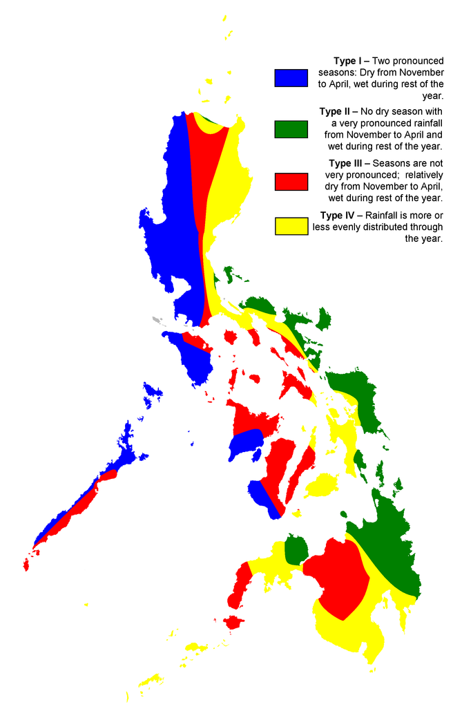
| current | 22:10, 4 March 2007 | | 2,000 × 3,120 (204 KB) | commons>Magalhães | {{Information |Description= |Source=map created by user:Howard the Duck based on map of Philippine meteorological institute [http://www.pagasa.dost.gov.ph/cab/coronas2.jpg PAG-ASA]; originally uploaded to English Wikipedia |Date=02/23/2007 |Author=[[:en:U |
File usage
There are no pages that use this file.