File:Pfaelzerwaldkarte kompakt.png
Jump to navigation
Jump to search
Size of this preview: 464 × 600 pixels. Other resolutions: 186 × 240 pixels | 371 × 480 pixels | 594 × 768 pixels | 792 × 1,024 pixels | 1,899 × 2,454 pixels.
Original file (1,899 × 2,454 pixels, file size: 7.38 MB, MIME type: image/png)
Summary
| Description |
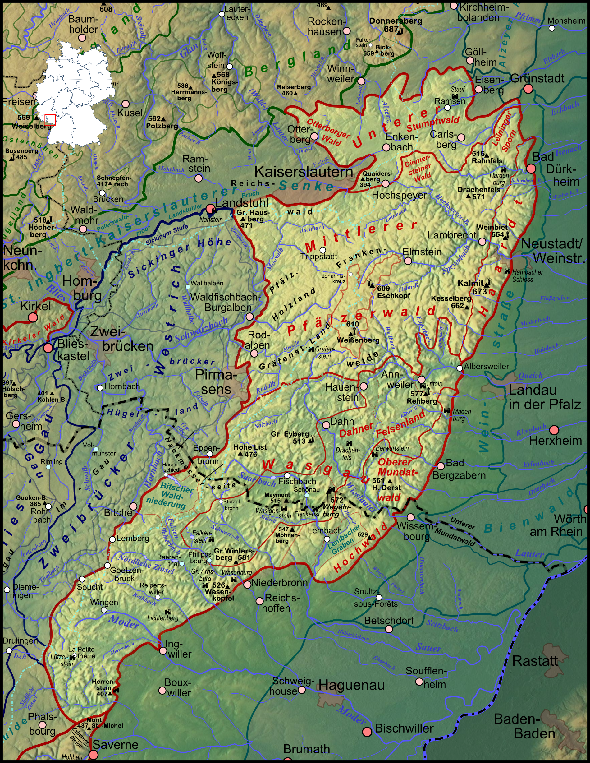
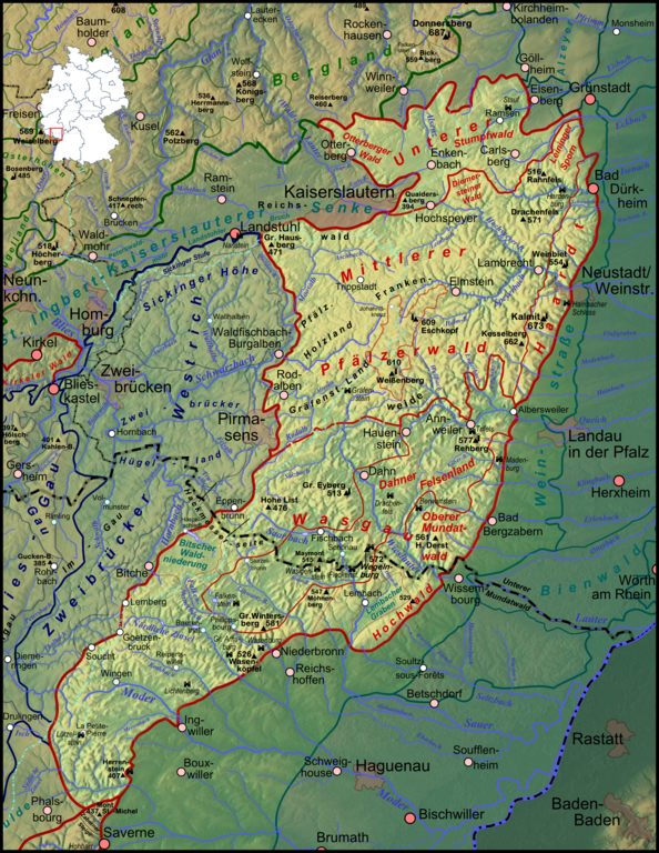
Deutsch: Karte des Pfälzerwaldes auf Basis der naturräumlichen Gliederung nach Pemöller et al und der Gliederung nach Geiger et al, siehe naturräumlich orientierte Hauptkarte |
| Date | |
| Source |
Own work
|
| Author | Elop, based on work by Lencer |
| Other versions |
|
Licensing

|
Permission is granted to copy, distribute and/or modify this document under the terms of the GNU Free Documentation License, Version 1.2 or any later version published by the Free Software Foundation; with no Invariant Sections, no Front-Cover Texts, and no Back-Cover Texts. A copy of the license is included in the section entitled GNU Free Documentation License. |
File history
Click on a date/time to view the file as it appeared at that time.
| Date/Time | Thumbnail | Dimensions | User | Comment | |
|---|---|---|---|---|---|
| current | 21:22, 8 February 2012 | | 1,899 × 2,454 (7.38 MB) | commons>Elop | komplettes Update |
File usage
There are no pages that use this file.