File:Pembroke Highways animation.gif
Jump to navigation
Jump to search
Size of this preview: 800 × 487 pixels. Other resolutions: 320 × 195 pixels | 640 × 390 pixels | 900 × 548 pixels.
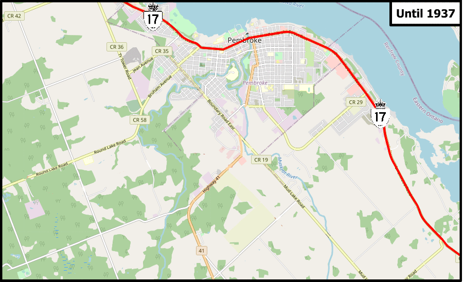
Original file (900 × 548 pixels, file size: 1.09 MB, MIME type: image/gif, looped, 9 frames, 21 s)
File history
Click on a date/time to view the file as it appeared at that time.
| Date/Time | Thumbnail | Dimensions | User | Comment | |
|---|---|---|---|---|---|
| current | 16:11, 24 May 2021 | | 900 × 548 (1.09 MB) | commons>Floydian | == Summary == Animation of Ontario highways in the Pembroke area between 1936 and 2021 Background map via OpenStreetMap Additions by Floydian, using the following Public Domain images: *File:Ontario 17.svg *File:Ontario 41.svg *File:Ontario 62.svg *File:Ontario 148.svg == Licensing == {{cc-by-sa-2.0}} |
File usage
There are no pages that use this file.