File:Pearl map lrg.gif
Jump to navigation
Jump to search
No higher resolution available.
Pearl_map_lrg.gif (600 × 540 pixels, file size: 18 KB, MIME type: image/gif)
File history
Click on a date/time to view the file as it appeared at that time.
| Date/Time | Thumbnail | Dimensions | User | Comment | |
|---|---|---|---|---|---|
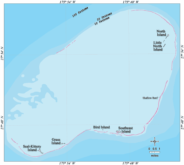
| current | 11:30, 21 February 2007 | | 600 × 540 (18 KB) | commons>Telim tor | == Information == {{Information |Description=en: Bathymetric map of Pearl and Hermes Atoll, Northwestern Hawaiian Islands de: Bathymetrische Karte des Pearl und Hermes-Atolls, Nordwestliche Hawaiische Inseln |Source=http://www.hawaiireef.noaa.gov/imagery |
File usage
There are no pages that use this file.