File:Part-of-Snake-River-in-Wyom.png
Jump to navigation
Jump to search
Size of this preview: 427 × 599 pixels. Other resolutions: 171 × 240 pixels | 447 × 627 pixels.
Original file (447 × 627 pixels, file size: 568 KB, MIME type: image/png)
File history
Click on a date/time to view the file as it appeared at that time.
| Date/Time | Thumbnail | Dimensions | User | Comment | |
|---|---|---|---|---|---|
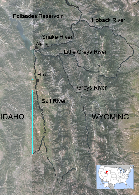
| current | 14:47, 22 January 2007 | | 447 × 627 (568 KB) | commons>Feydey | {{Information |Description= Map of Greys River in Wyoming, United States. |Source=Nasa World Wind 1.3.5 public domain NLT Landsat 7 satellite photo, layered with PD vmap0 vector data. Image:Map_of_USA_highlighting_Wyoming.png was u |
File usage
There are no pages that use this file.