File:Pant Mawr map 1889-1900.jpg
Jump to navigation
Jump to search
Size of this preview: 800 × 526 pixels. Other resolutions: 320 × 210 pixels | 640 × 421 pixels | 1,024 × 673 pixels | 1,280 × 841 pixels | 1,750 × 1,150 pixels.
Original file (1,750 × 1,150 pixels, file size: 614 KB, MIME type: image/jpeg)


Summary
| Description |
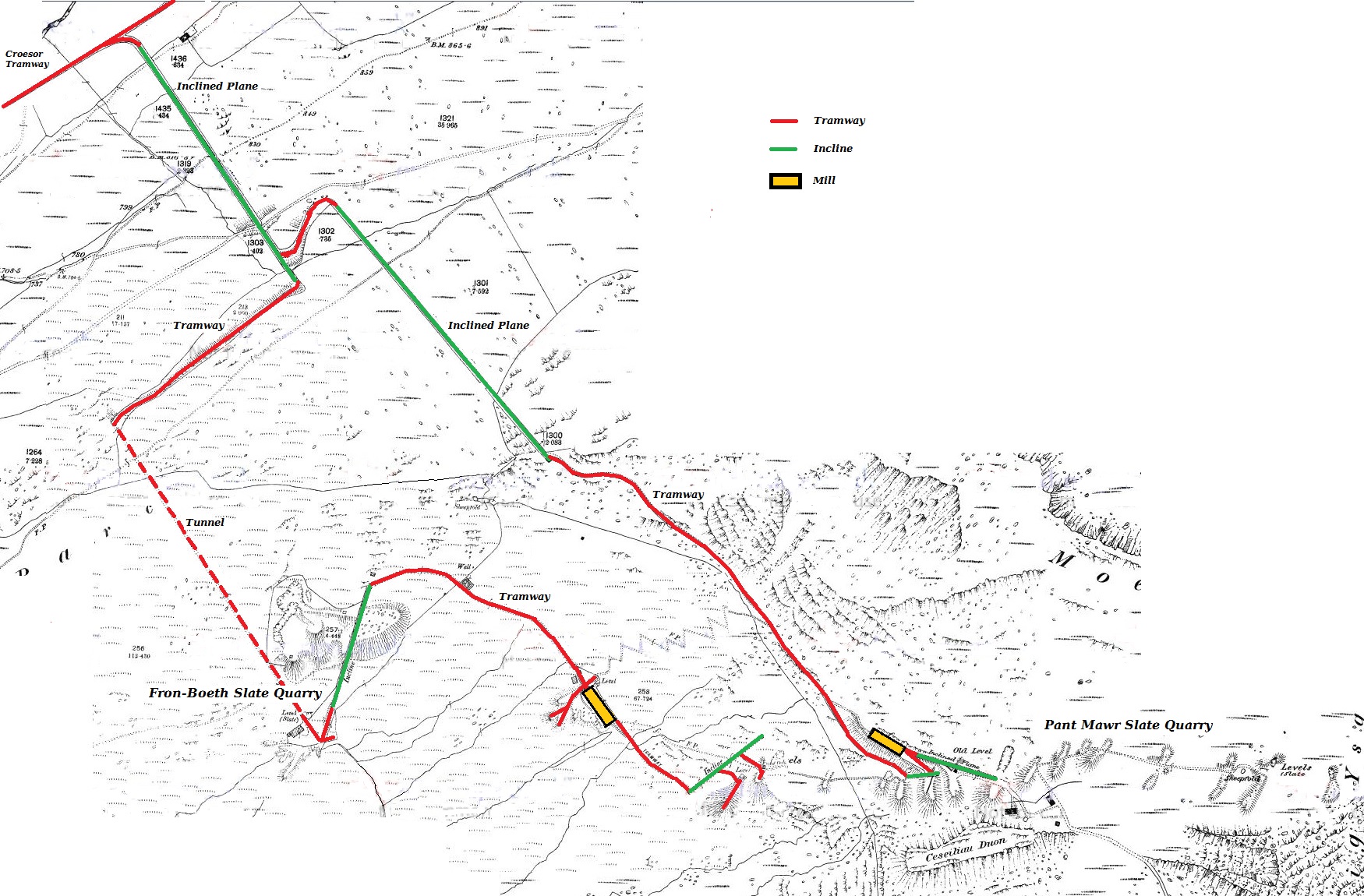
English: A composite map of the Pant Mawr and Fron-Boeth quarries in Gwynedd, North Wales. The Pant Mawr section dates from 1889, and the Fron-Boeth section dates from 1900. |
| Date | |
| Source | Ordnance Survey maps from 1889 and 1900, with coloured overlays by Bob1960evens |
| Author | Ordnance Survey |
Licensing
This work created by the United Kingdom Government is in the public domain.
This is because it is one of the following:
HMSO has declared that the expiry of Crown Copyrights applies worldwide (ref: HMSO Email Reply)
|
 |
This mapping was published by the Ordnance Survey in 1889 and 1900, and is more than 50 years old.
File history
Click on a date/time to view the file as it appeared at that time.
| Date/Time | Thumbnail | Dimensions | User | Comment | |
|---|---|---|---|---|---|
| current | 15:28, 7 October 2016 | | 1,750 × 1,150 (614 KB) | commons>Bob1960evens | User created page with UploadWizard |
File usage
There are no pages that use this file.