File:Palliser's Triangle map.png
Jump to navigation
Jump to search

Size of this preview: 780 × 600 pixels. Other resolutions: 312 × 240 pixels | 624 × 480 pixels | 1,000 × 769 pixels.
Original file (1,000 × 769 pixels, file size: 301 KB, MIME type: image/png)
File history
Click on a date/time to view the file as it appeared at that time.
| Date/Time | Thumbnail | Dimensions | User | Comment | |
|---|---|---|---|---|---|
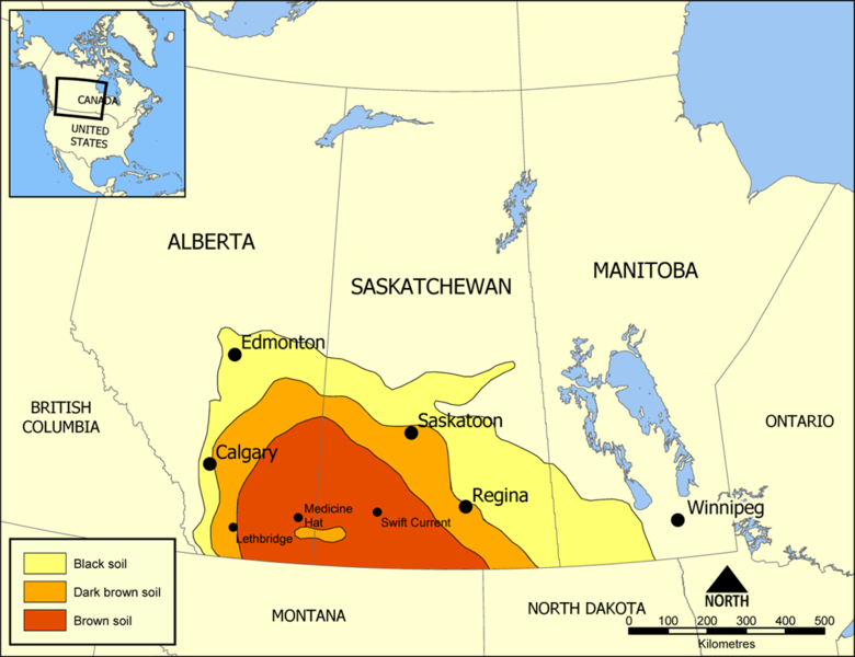
| current | 15:50, 18 July 2005 | | 1,000 × 769 (301 KB) | commons>NormanEinstein | Map showing the extent of Palliser's Triangle in Western Canada. The area covers parts of Alberta, Saskatchewan, and Manitoba and is notable for its lack of trees. The lack of sturdy vegetation devastated the area during the Dust Bowl of the 1930s, but mo |
File usage
There are no pages that use this file.