File:Pacific intertie geographic map.png
Jump to navigation
Jump to search
Size of this preview: 309 × 599 pixels. Other resolutions: 124 × 240 pixels | 247 × 480 pixels | 854 × 1,655 pixels.
Original file (854 × 1,655 pixels, file size: 154 KB, MIME type: image/png)
File history
Click on a date/time to view the file as it appeared at that time.
| Date/Time | Thumbnail | Dimensions | User | Comment | |
|---|---|---|---|---|---|
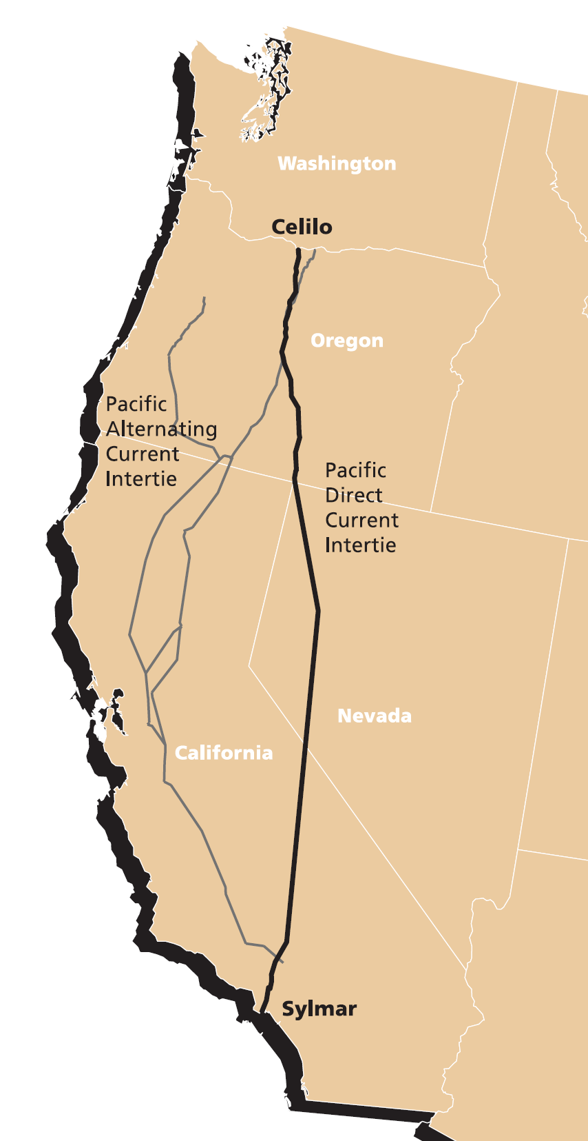
| current | 01:59, 9 March 2007 | | 854 × 1,655 (154 KB) | commons>EncMstr | {{Information |Description=Map of Pacific Intertie HVDC electrical transmission line from Celilo Converter Station near The Dalles, Oregon to the Sylmar Converter Station |
File usage
There are no pages that use this file.