File:Osagerivermap.png
Jump to navigation
Jump to search

Size of this preview: 600 × 600 pixels. Other resolutions: 240 × 240 pixels | 480 × 480 pixels | 750 × 750 pixels.
Original file (750 × 750 pixels, file size: 265 KB, MIME type: image/png)
File history
Click on a date/time to view the file as it appeared at that time.
| Date/Time | Thumbnail | Dimensions | User | Comment | |
|---|---|---|---|---|---|
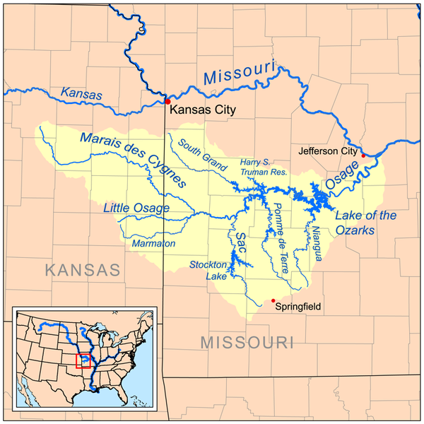
| current | 16:10, 16 July 2008 | | 750 × 750 (265 KB) | commons>Kmusser | == Summary == {{Information |Description=Map of the Osage River watershed. |Source=Self-made, based on USGS data. |Author=Kmusser |Date=July 16, 2008 |Permission= |other_versions= }} [[Category:Maps of ri |
File usage
There are no pages that use this file.