File:Országos Kéktúra map.svg
Jump to navigation
Jump to search

Size of this PNG preview of this SVG file: 800 × 494 pixels. Other resolutions: 320 × 198 pixels | 640 × 395 pixels | 1,024 × 632 pixels | 1,280 × 790 pixels | 2,560 × 1,580 pixels | 951 × 587 pixels.
Original file (SVG file, nominally 951 × 587 pixels, file size: 1.89 MB)
File history
Click on a date/time to view the file as it appeared at that time.
| Date/Time | Thumbnail | Dimensions | User | Comment | |
|---|---|---|---|---|---|
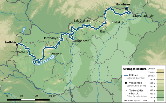
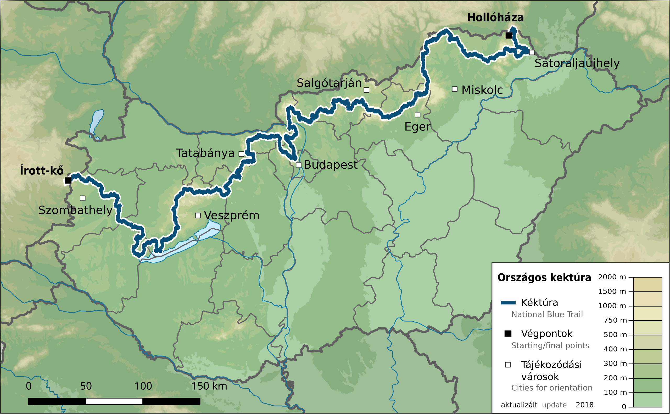
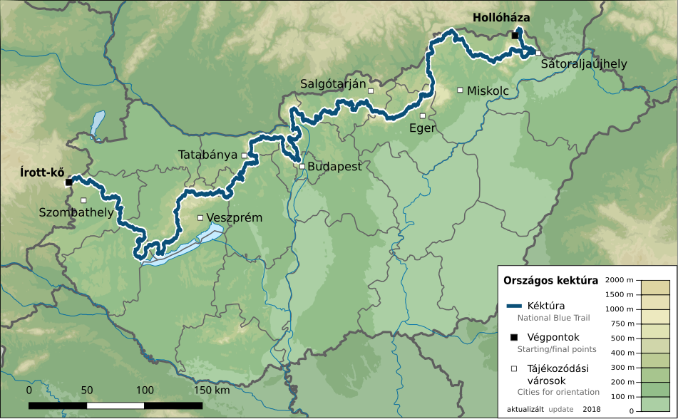
| current | 18:48, 4 November 2018 | | 951 × 587 (1.89 MB) | commons>Földhegy | {{Information |Description={{en|Map of the {{w|National Blue Trail}}, Hungary}} {{hu|Az {{w|Országos Kéktúra|3=hu}} téképe}} |Source={{own}}, using * File:Hungary physical map.svg by {{u|Urutseg}} * OpenStreetMap data ([https://www.openstreetmap.org/relation/3020505 relation 3020505]) |Date=2018-11-04 |Author={{u|Földhegy}} |Permission={{ODbL OpenStreetMap}} {{CC-BY-SA-3.0}} |other_versions= }} Category:SVG maps of Hungary Category:National Blue Trail [[Category:Hiking maps o... |
File usage
There are no pages that use this file.