File:Operation Tractable.svg
Jump to navigation
Jump to search

Size of this PNG preview of this SVG file: 490 × 599 pixels. Other resolutions: 196 × 240 pixels | 393 × 480 pixels | 628 × 768 pixels | 837 × 1,024 pixels | 1,675 × 2,048 pixels | 548 × 670 pixels.
Original file (SVG file, nominally 548 × 670 pixels, file size: 493 KB)
File history
Click on a date/time to view the file as it appeared at that time.
| Date/Time | Thumbnail | Dimensions | User | Comment | |
|---|---|---|---|---|---|
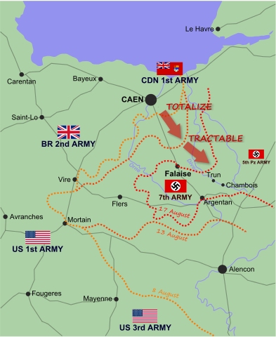
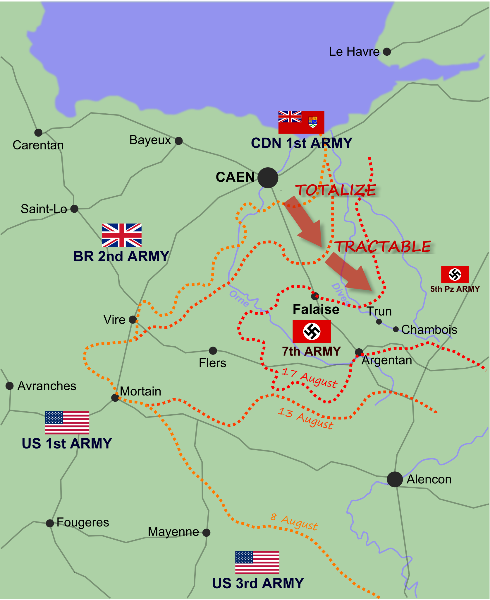
| current | 17:23, 16 July 2010 | | 548 × 670 (493 KB) | commons>EyeSerene | {{Information |Description={{en|1={{en|1=Map of Allied and German positions around Falaise, Normandy from 8-17 August 1944, illustrating the Canadian offensives of Operation Totalize and Operation Tractable.}}}} |Source={{own}} |Author=~~~ |Date=~~~~~ |Pe |
File usage
There are no pages that use this file.