File:Operation Tractable.png
Jump to navigation
Jump to search
Size of this preview: 491 × 600 pixels. Other resolutions: 196 × 240 pixels | 550 × 672 pixels.
Original file (550 × 672 pixels, file size: 136 KB, MIME type: image/png)

|
File:Operation Tractable.svg is a vector version of this file. It should be used in place of this PNG file when not inferior.
File:Operation Tractable.png → File:Operation Tractable.svg
For more information, see Help:SVG. |
 |
Summary
| Description |
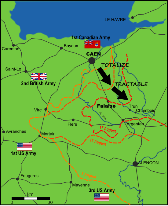
English: Map of Allied and German positions around Falaise, Normandy from 8-17 August 1944, illustrating the Canadian offensives of Operation Totalize and Operation Tractable. |
| Date | |
| Source | Own work |
| Author | EyeSerene |
New version uploaded to correct mistake in original, 10 October 2008.
Licensing
| I, the copyright holder of this work, release this work into the public domain. This applies worldwide. In some countries this may not be legally possible; if so: I grant anyone the right to use this work for any purpose, without any conditions, unless such conditions are required by law. |
File history
Click on a date/time to view the file as it appeared at that time.
| Date/Time | Thumbnail | Dimensions | User | Comment | |
|---|---|---|---|---|---|
| current | 00:46, 20 April 2012 | | 550 × 672 (136 KB) | commons>Kbh3rd | Added map scale bar |
File usage
There are no pages that use this file.