File:Ontario Highway 62 - 1937-38.png
Jump to navigation
Jump to search
No higher resolution available.
Ontario_Highway_62_-_1937-38.png (715 × 510 pixels, file size: 686 KB, MIME type: image/png)
File history
Click on a date/time to view the file as it appeared at that time.
| Date/Time | Thumbnail | Dimensions | User | Comment | |
|---|---|---|---|---|---|
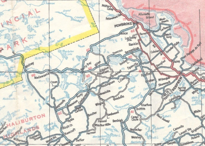
| current | 00:24, 11 January 2021 | | 715 × 510 (686 KB) | commons>Floydian | == Summary == {{Information | description = 1937–38 map of Ontario, showing towns and numbered highways northwest of Ottawa. Of note is the section of Ontario Highway 62 between Barry's Bay and Round Lake, which was never built. | source = Ontario Road Map, 1937–38 edition. Cartography by D. Barclay. | date = 1937–38 | author = Ontario Department of Highways (Ministry of Transportation of Ontario) | permission = {{PD-Canada-Crown}} | other_versions = | additional_in... |
File usage
There are no pages that use this file.