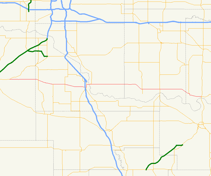
File:Ok-39 path.png
Jump to navigation
Jump to search

Size of this preview: 717 × 599 pixels. Other resolutions: 287 × 240 pixels | 574 × 480 pixels | 944 × 789 pixels.
Original file (944 × 789 pixels, file size: 45 KB, MIME type: image/png)
File history
Click on a date/time to view the file as it appeared at that time.
| Date/Time | Thumbnail | Dimensions | User | Comment | |
|---|---|---|---|---|---|
| current | 19:18, 6 February 2007 | | 944 × 789 (45 KB) | commons>Scott5114 | {{Information |Description=Map of Oklahoma State Highway 39. |Source=Made from data from the [http://geo.ou.edu/cgi-bin/redesign.cgi?ft=db&template=Data.htm University of Oklahoma Geo Information Systems] in [[w:Quantum GIS |
File usage
There are no pages that use this file.