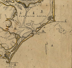
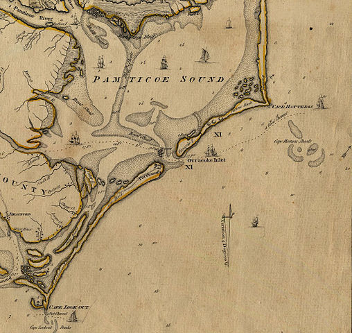
File:Ocracoke inlet north carolina 1775.jpg
Jump to navigation
Jump to search

Size of this preview: 635 × 600 pixels. Other resolutions: 254 × 240 pixels | 508 × 480 pixels | 813 × 768 pixels | 1,025 × 968 pixels.
Original file (1,025 × 968 pixels, file size: 333 KB, MIME type: image/jpeg)
File history
Click on a date/time to view the file as it appeared at that time.
| Date/Time | Thumbnail | Dimensions | User | Comment | |
|---|---|---|---|---|---|
| current | 21:45, 6 February 2010 | | 1,025 × 968 (333 KB) | commons>Parrot of Doom | {{Information |Description={{en|1=An Accurate Map of North and South Carolina With Their Indian Frontiers, Shewing in a distinct manner all the Mountains, Rivers, Swamps, Marshes, Bays, Creeks, Harbours, Sandbanks and Soundings on the Coasts; with The Roa |
File usage
There are no pages that use this file.