File:Nova Scotia-map.png
Jump to navigation
Jump to search
No higher resolution available.
Nova_Scotia-map.png (280 × 230 pixels, file size: 14 KB, MIME type: image/png)
File history
Click on a date/time to view the file as it appeared at that time.
| Date/Time | Thumbnail | Dimensions | User | Comment | |
|---|---|---|---|---|---|
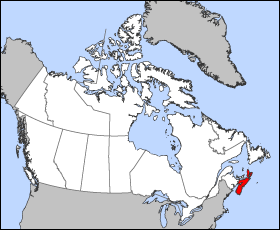
| current | 12:16, 24 March 2005 | | 280 × 230 (14 KB) | commons>Voyager | Map of Nova Scotia Projection: Lambert azimuthal equal-area Geospatial data from: [http://atlas.gc.ca/ The Atlas of Canada], [http://www.nationalatlas.gov/ The National Atlas of the United States] and [http://www.usgs.gov U.S. Geological Survey] Cartog |
File usage
There are no pages that use this file.