File:Northern Minnesota Parks map.gif
Jump to navigation
Jump to search

Size of this preview: 587 × 599 pixels. Other resolutions: 235 × 240 pixels | 470 × 480 pixels | 806 × 823 pixels.
Original file (806 × 823 pixels, file size: 42 KB, MIME type: image/gif)
File history
Click on a date/time to view the file as it appeared at that time.
| Date/Time | Thumbnail | Dimensions | User | Comment | |
|---|---|---|---|---|---|
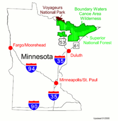
| current | 18:43, 8 September 2005 | | 806 × 823 (42 KB) | commons>Ravedave | Map of parks and forests in Northern Minnesota . The parks are: Superior National Forest, Voyageurs National Park and the Boundary Waters Canoe Area. Source: US Forest Service {{PD-USGov-USDA}} Category:Voyageurs_National_Park[[Category:Superior N |
File usage
There are no pages that use this file.