File:North backa.png
Jump to navigation
Jump to search

Size of this preview: 454 × 599 pixels. Other resolutions: 182 × 240 pixels | 510 × 673 pixels.
Original file (510 × 673 pixels, file size: 31 KB, MIME type: image/png)
| Description |
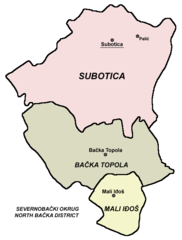
English: map of en:North Bačka District
Српски / srpski: Мапа Севернобачког округа |
||
| Source | self made map by user:PANONIAN | ||
| Author | User PANONIAN on en.wikipedia | ||
| Permission (Reusing this file) |
|
||
| Other versions |
Originally from en.wikipedia; description page is (was) here * 03:26, 9 December 2005 [[:en:User:PANONIAN|PANONIAN]] 454×580 (6,243 bytes) |
References
- Slobodan Radovanović, Geografski atlas, Magic Map, Smederevska Palanka, 2001.
- Školski geografski atlas, Intersistem Kartografija, Beograd, 2004.
- Denis Šehić - Demir Šehić, Geografski atlas Srbije, Beograd, 2007.
- Popis stanovništva, domaćinstava i stanova u 2002., Stanovništvo, nacionalna ili etnička pripadnost - Podaci po naseljima, knjiga 1, Republika Srbija - Republički zavod za statistiku, Beograd, februar 2003.
Note
(Uploaded using CommonsHelper or PushForCommons)
File history
Click on a date/time to view the file as it appeared at that time.
| Date/Time | Thumbnail | Dimensions | User | Comment | |
|---|---|---|---|---|---|
| current | 19:26, 12 September 2009 | | 510 × 673 (31 KB) | commons>PANONIAN |
File usage
There are no pages that use this file.