File:North West 2011 population density map.svg
Jump to navigation
Jump to search

Size of this PNG preview of this SVG file: 800 × 548 pixels. Other resolutions: 320 × 219 pixels | 640 × 439 pixels | 1,024 × 702 pixels | 1,280 × 877 pixels | 2,560 × 1,755 pixels | 1,208 × 828 pixels.
Original file (SVG file, nominally 1,208 × 828 pixels, file size: 996 KB)
File history
Click on a date/time to view the file as it appeared at that time.
| Date/Time | Thumbnail | Dimensions | User | Comment | |
|---|---|---|---|---|---|
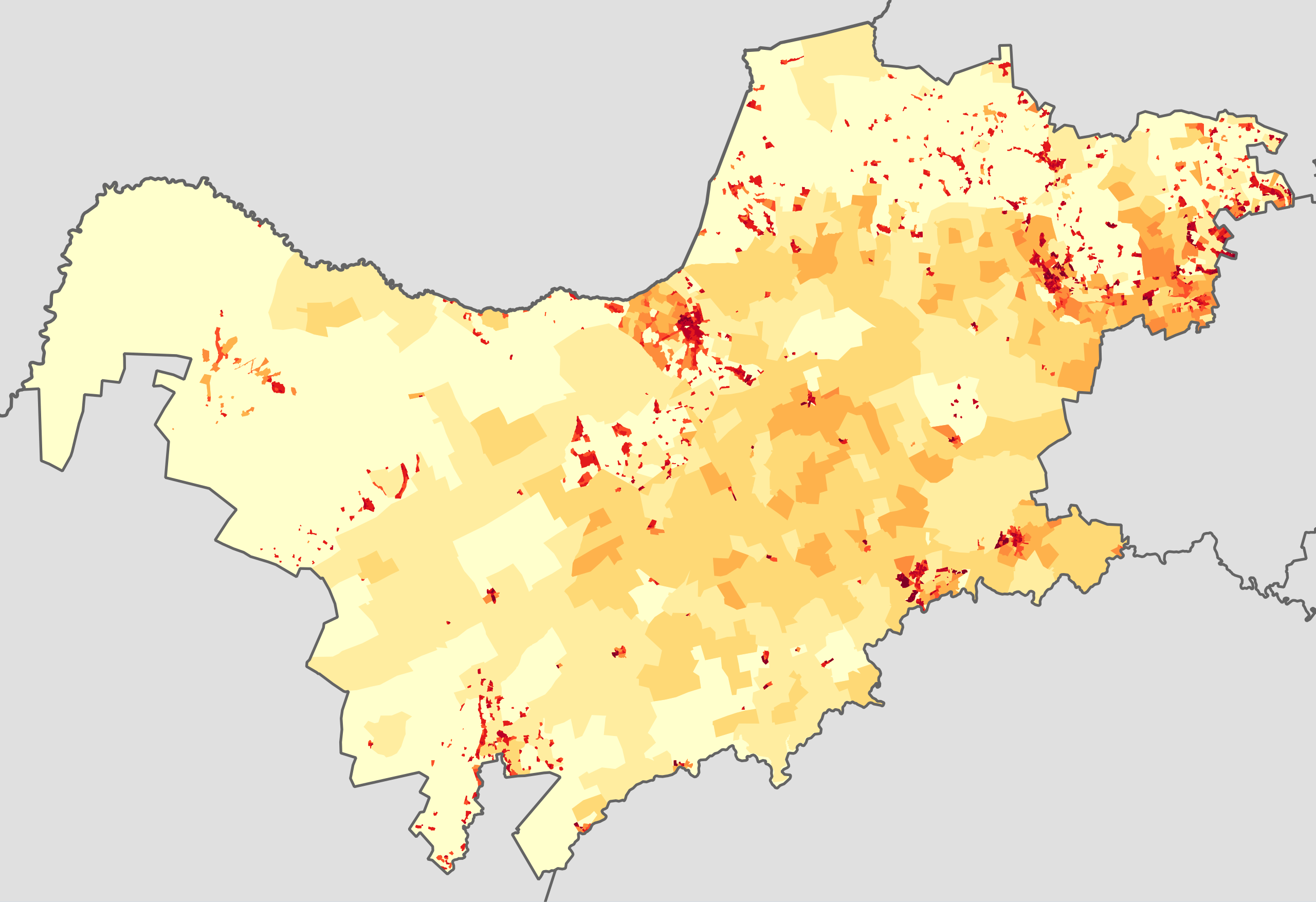
| current | 18:34, 22 October 2013 | | 1,208 × 828 (996 KB) | commons>Htonl | == {{int:filedesc}} == {{Information |Description={{en|1=Population density map of the North West province of South Africa, from the 2011 Census, at the "Small Area" level. {{legend|#ffffcc|<1 inhabitant/km²}} {{legend|#ffeda0|1–3 inhabitants/km... |
File usage
There are no pages that use this file.