File:Norfolk UK local election results 2011 map.svg
Jump to navigation
Jump to search

Size of this PNG preview of this SVG file: 800 × 497 pixels. Other resolutions: 320 × 199 pixels | 640 × 398 pixels | 1,024 × 637 pixels | 1,280 × 796 pixels | 2,560 × 1,592 pixels | 1,425 × 886 pixels.
Original file (SVG file, nominally 1,425 × 886 pixels, file size: 2.02 MB)
Summary
| Description |
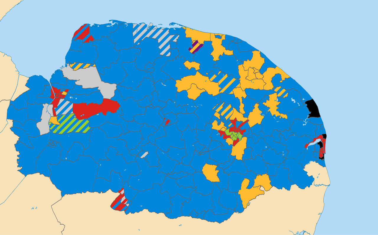
English: Results of all District, Borough and City Council elections held in May 2011.
Colours: Conservative
Liberal Democrat
Labour
Green
Independent (politician)
UKIP
Wards not being contested at these elections
Striped wards have mixed representation. |
| Date | |
| Source | Derived from File:Norfolk_UK_electoral_division_map_(blank).svg, created by Nilfanion using Ordnance Survey OpenData. |
| Author | Woodgreener, derived from work by Nilfanion using Ordnance Survey OpenData |
.svg)
Licensing
This file is licensed under the Creative Commons Attribution-Share Alike 3.0 Unported license.
Attribution: Contains Ordnance Survey data © Crown copyright and database right
- You are free:
- to share – to copy, distribute and transmit the work
- to remix – to adapt the work
- Under the following conditions:
- attribution – You must give appropriate credit, provide a link to the license, and indicate if changes were made. You may do so in any reasonable manner, but not in any way that suggests the licensor endorses you or your use.
- share alike – If you remix, transform, or build upon the material, you must distribute your contributions under the same or compatible license as the original.
File history
Click on a date/time to view the file as it appeared at that time.
| Date/Time | Thumbnail | Dimensions | User | Comment | |
|---|---|---|---|---|---|
| current | 22:57, 11 December 2012 | | 1,425 × 886 (2.02 MB) | commons>Woodgreener | User created page with UploadWizard |
File usage
There are no pages that use this file.