File:Nocton Heath Farm map.svg
Jump to navigation
Jump to search

Size of this PNG preview of this SVG file: 634 × 552 pixels. Other resolutions: 276 × 240 pixels | 551 × 480 pixels | 882 × 768 pixels | 1,176 × 1,024 pixels | 2,352 × 2,048 pixels.
Original file (SVG file, nominally 634 × 552 pixels, file size: 81 KB)

Summary
| Description |
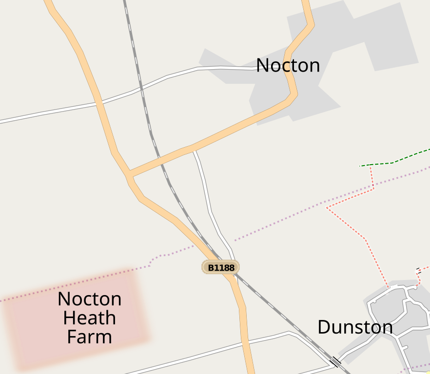
English: Approximate location plan for Nocton Heath Farm, site for the Nocton Dairies mega-dairy. The location plan is based on the publicly available planning application RAC/4448/01/A (planningonline.n-kesteven.gov.uk). The diagram itself is underpinned by free licensed data from the OpenStreetMap project. |
| Date | |
| Source | Own work |
| Author | Fæ |
Source:
Own work
Licensing
This file is licensed under the Creative Commons Attribution-Share Alike 3.0 Unported license.
Attribution: Fæ
- You are free:
- to share – to copy, distribute and transmit the work
- to remix – to adapt the work
- Under the following conditions:
- attribution – You must give appropriate credit, provide a link to the license, and indicate if changes were made. You may do so in any reasonable manner, but not in any way that suggests the licensor endorses you or your use.
- share alike – If you remix, transform, or build upon the material, you must distribute your contributions under the same or compatible license as the original.
File history
Click on a date/time to view the file as it appeared at that time.
| Date/Time | Thumbnail | Dimensions | User | Comment | |
|---|---|---|---|---|---|
| current | 14:20, 21 October 2010 | | 634 × 552 (81 KB) | commons>Fæ | Further tweak to text sizes. |
File usage
There are no pages that use this file.