File:New South Wales LGA map by largest council faction.svg
Jump to navigation
Jump to search

Size of this PNG preview of this SVG file: 800 × 521 pixels. Other resolutions: 320 × 208 pixels | 640 × 417 pixels | 1,024 × 667 pixels | 1,280 × 833 pixels | 2,560 × 1,666 pixels | 2,389 × 1,555 pixels.
Original file (SVG file, nominally 2,389 × 1,555 pixels, file size: 1.77 MB)
Summary

|
This image is expected to always be the most recent one. Feel free to update it when needed.
|
| Description |
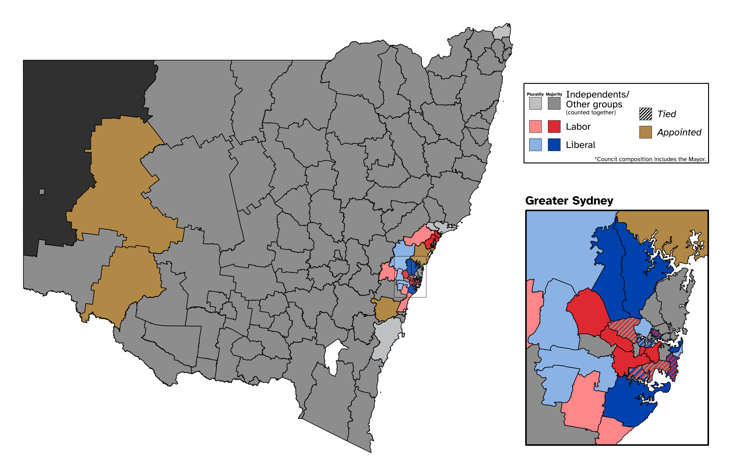
English: A map of local government areas in New South Wales by the largest faction in each council, with grey for independents, red for Labor, blue for Liberal, and stripes for two or more factions tied for largest number of seats, while brown is for councils with administrators appointed by the state government. Shapefile from the Australian Bureau of Statistics, released under CC BY 4.0. Party information from ABC News. Made with Mapshaper and Inkscape |
| Date | |
| Source | Own work |
| Author | Twotwofourtysix |
Licensing
I, the copyright holder of this work, hereby publish it under the following license:
This file is licensed under the Creative Commons Attribution 4.0 International license.
- You are free:
- to share – to copy, distribute and transmit the work
- to remix – to adapt the work
- Under the following conditions:
- attribution – You must give appropriate credit, provide a link to the license, and indicate if changes were made. You may do so in any reasonable manner, but not in any way that suggests the licensor endorses you or your use.
File history
Click on a date/time to view the file as it appeared at that time.
| Date/Time | Thumbnail | Dimensions | User | Comment | |
|---|---|---|---|---|---|
| current | 10:48, 31 December 2022 | | 2,389 × 1,555 (1.77 MB) | commons>Twotwofourtysix | Adds note |
File usage
There are no pages that use this file.