File:Netherlands, Veur, map of 1867.jpg
Jump to navigation
Jump to search

Size of this preview: 703 × 600 pixels. Other resolutions: 281 × 240 pixels | 563 × 480 pixels | 900 × 768 pixels | 1,201 × 1,024 pixels | 2,340 × 1,996 pixels.
Original file (2,340 × 1,996 pixels, file size: 1.79 MB, MIME type: image/jpeg)
File history
Click on a date/time to view the file as it appeared at that time.
| Date/Time | Thumbnail | Dimensions | User | Comment | |
|---|---|---|---|---|---|
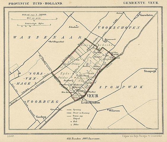
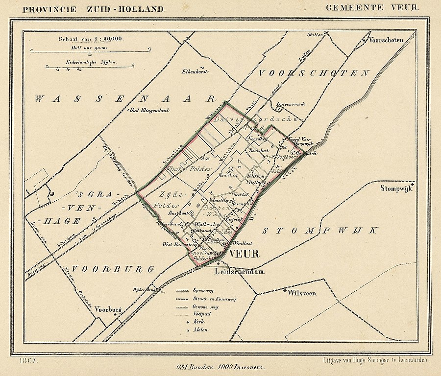
| current | 21:31, 13 December 2011 | | 2,340 × 1,996 (1.79 MB) | commons>Loranchet | {{Information |Description ={{nl|1=Kaart uit 1867 van de gemeente Veur (Zuid-Holland). Veur fuseerde in 1938 met Stompwijk tot Leidschendam.}} {{en|1=Map from 1867 of the former municipality of Veur (Province of South Holland, Netherlands). In 1938 Veu |
File usage
There are no pages that use this file.