File:Nelson Mandela Bay 2011 population density map.svg
Jump to navigation
Jump to search

Size of this PNG preview of this SVG file: 666 × 600 pixels. Other resolutions: 267 × 240 pixels | 533 × 480 pixels | 853 × 768 pixels | 1,137 × 1,024 pixels | 2,275 × 2,048 pixels | 913 × 822 pixels.
Original file (SVG file, nominally 913 × 822 pixels, file size: 157 KB)
File history
Click on a date/time to view the file as it appeared at that time.
| Date/Time | Thumbnail | Dimensions | User | Comment | |
|---|---|---|---|---|---|
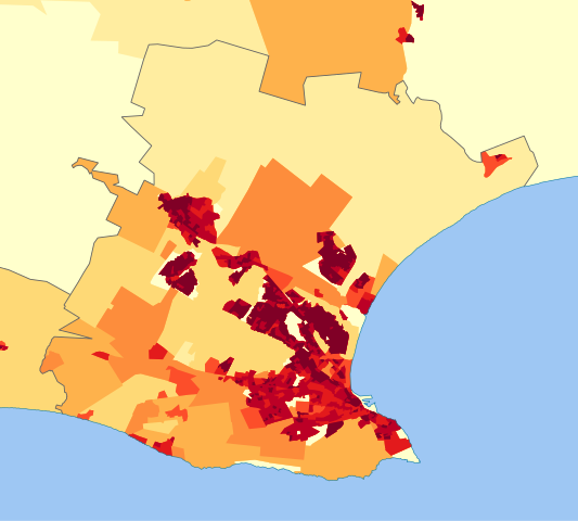
| current | 14:30, 13 October 2013 | | 913 × 822 (157 KB) | commons>Htonl | == {{int:filedesc}} == {{Information |Description={{en|1=Population density map of the Nelson Mandela Bay Metro, Eastern Cape, South Africa, from the 2011 Census, at the "Small Area" level. {{legend|#ffffcc|<1 inhabitant/km²}} {{legend|#ffeda0|1–... |
File usage
There are no pages that use this file.