File:NaziGaue.png
Jump to navigation
Jump to search
Size of this preview: 698 × 600 pixels. Other resolutions: 279 × 240 pixels | 559 × 480 pixels | 894 × 768 pixels | 1,224 × 1,052 pixels.
Original file (1,224 × 1,052 pixels, file size: 431 KB, MIME type: image/png)
File history
Click on a date/time to view the file as it appeared at that time.
| Date/Time | Thumbnail | Dimensions | User | Comment | |
|---|---|---|---|---|---|
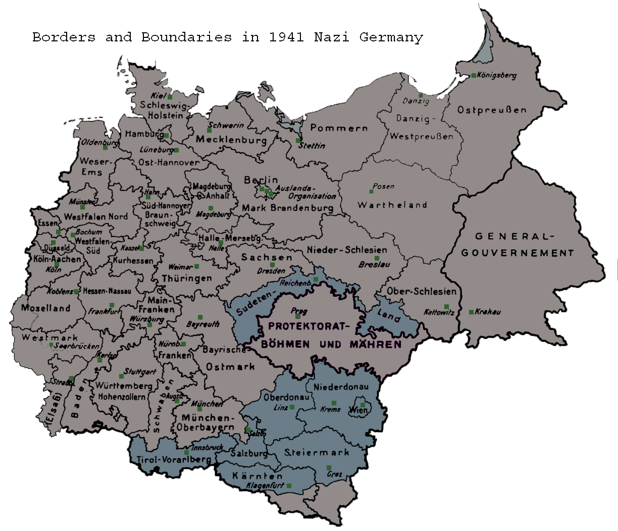
| current | 05:39, 21 June 2007 | | 1,224 × 1,052 (431 KB) | commons>Moonian | {{Information |Description=Map of the administrative districts in territories under the control of Nazi Germany in 1941. This map shows administration borders and has been retouched from the original Wiki Commons image. Specifically, German descriptions |
File usage
There are no pages that use this file.