File:Nationalpark-Schwarzwald-map.png
Jump to navigation
Jump to search

Size of this preview: 517 × 599 pixels. Other resolutions: 207 × 240 pixels | 414 × 480 pixels | 724 × 839 pixels.
Original file (724 × 839 pixels, file size: 823 KB, MIME type: image/png)
File history
Click on a date/time to view the file as it appeared at that time.
| Date/Time | Thumbnail | Dimensions | User | Comment | |
|---|---|---|---|---|---|
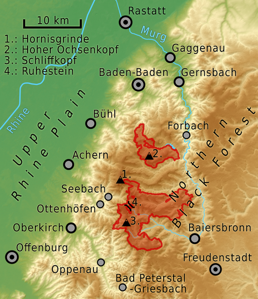
| current | 20:29, 5 September 2014 | | 724 × 839 (823 KB) | commons>Sitacuisses | {{Information |Description ={{en|1=The north-western Black Forest with the Black Forest National Park (Nationalpark Schwarzwald), Germany. Map based on NASA SRTM-3 data.}} |Source ={{own}} |Author =Sitacuisses ht... |
File usage
There are no pages that use this file.