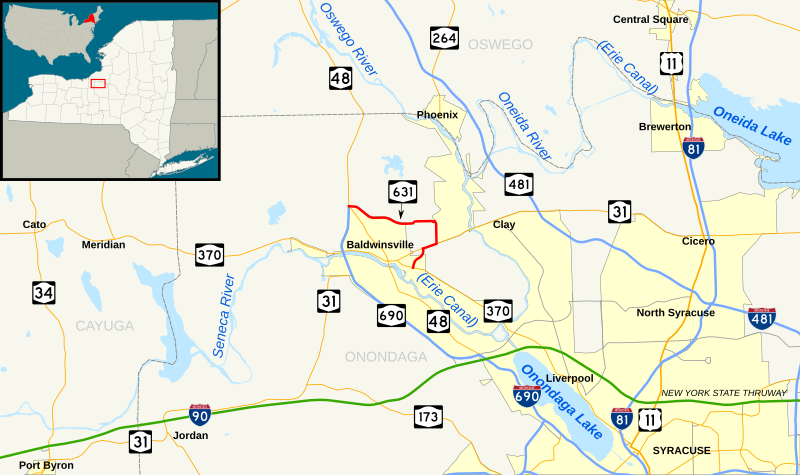
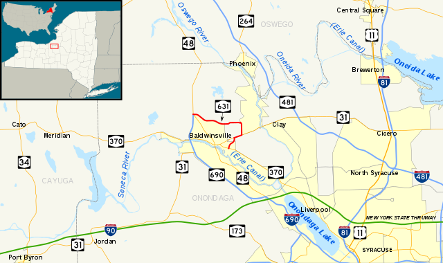
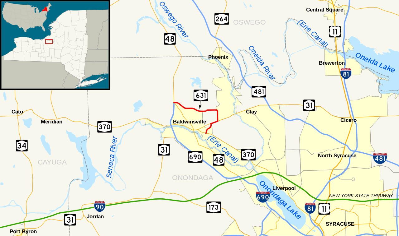
File:NY Route 631 map.svg
Jump to navigation
Jump to search

Size of this PNG preview of this SVG file: 800 × 474 pixels. Other resolutions: 320 × 190 pixels | 640 × 380 pixels | 1,024 × 607 pixels | 1,280 × 759 pixels | 2,560 × 1,518 pixels | 1,450 × 860 pixels.
Original file (SVG file, nominally 1,450 × 860 pixels, file size: 590 KB)
File history
Click on a date/time to view the file as it appeared at that time.
| Date/Time | Thumbnail | Dimensions | User | Comment | |
|---|---|---|---|---|---|
| current | 21:35, 19 April 2012 | | 1,450 × 860 (590 KB) | commons>TwinsMetsFan | == {{int:filedesc}} == {{Information |Description ={{en|1=Map of New York State Route 631. Base map made in Quantum GIS using GIS data from the United States Census Bureau ([http://arcdata.esri.com/data/tiger2000/tig... |
File usage
There are no pages that use this file.