File:NPS pinnacles-map.jpg
Jump to navigation
Jump to search

Size of this preview: 461 × 599 pixels. Other resolutions: 185 × 240 pixels | 369 × 480 pixels | 591 × 768 pixels | 788 × 1,024 pixels | 1,862 × 2,420 pixels.
Original file (1,862 × 2,420 pixels, file size: 600 KB, MIME type: image/jpeg)
File history
Click on a date/time to view the file as it appeared at that time.
| Date/Time | Thumbnail | Dimensions | User | Comment | |
|---|---|---|---|---|---|
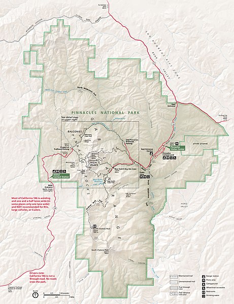
| current | 01:52, 17 May 2017 | | 1,862 × 2,420 (600 KB) | commons>RKBot | =={{int:filedesc}}== {{Information |description= {{en|1=Main Pinnacles National Park map, showing roads, hiking trails, campgrounds, visitor centers, and points of interest.}} |date= 2015-08-14 |source= U.S. National Park Service (http://npmaps.com/wp-... |
File usage
There are no pages that use this file.