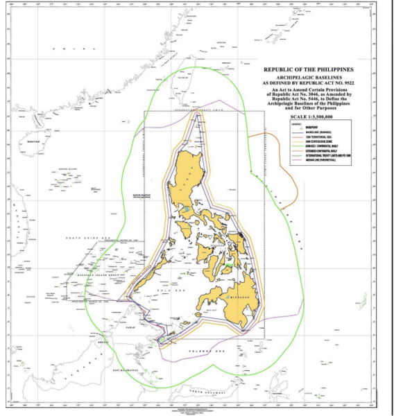
File:NAMRIA map of Philippine maritime zones.png
Jump to navigation
Jump to search

Size of this preview: 581 × 600 pixels. Other resolutions: 232 × 240 pixels | 465 × 480 pixels | 644 × 665 pixels.
Original file (644 × 665 pixels, file size: 327 KB, MIME type: image/png)
File history
Click on a date/time to view the file as it appeared at that time.
| Date/Time | Thumbnail | Dimensions | User | Comment | |
|---|---|---|---|---|---|
| current | 03:34, 19 April 2024 | | 644 × 665 (327 KB) | commons>Wtmitchell | Uploaded a work by National Mapping and Resource Information Authority of the Philippines from https://ro.uow.edu.au/cgi/viewcontent.cgi?article=1773&context=lhapapers page 40. See also EndNote 2 there and see NAMRIA. with UploadWizard |
File usage
There are no pages that use this file.