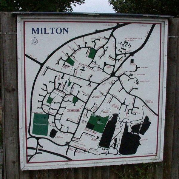
File:Milton Village map - geograph.org.uk - 823107.jpg
Jump to navigation
Jump to search

Size of this preview: 600 × 600 pixels. Other resolutions: 240 × 240 pixels | 480 × 480 pixels | 640 × 640 pixels.
Original file (640 × 640 pixels, file size: 140 KB, MIME type: image/jpeg)
File history
Click on a date/time to view the file as it appeared at that time.
| Date/Time | Thumbnail | Dimensions | User | Comment | |
|---|---|---|---|---|---|
| current | 16:15, 20 February 2011 | | 640 × 640 (140 KB) | commons>GeographBot | == {{int:filedesc}} == {{Information |description={{en|1=Milton Village map This map, at the southern end of the High Street, shows the wave of new housing estate building which has occurred within the sweeping line of the bypass at the top and left since |
File usage
There are no pages that use this file.