File:Meli 1979 track.png
Jump to navigation
Jump to search
Size of this preview: 771 × 599 pixels. Other resolutions: 309 × 240 pixels | 618 × 480 pixels | 988 × 768 pixels | 1,024 × 796 pixels.
Original file (1,024 × 796 pixels, file size: 98 KB, MIME type: image/png)
File history
Click on a date/time to view the file as it appeared at that time.
| Date/Time | Thumbnail | Dimensions | User | Comment | |
|---|---|---|---|---|---|
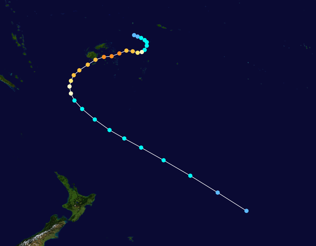
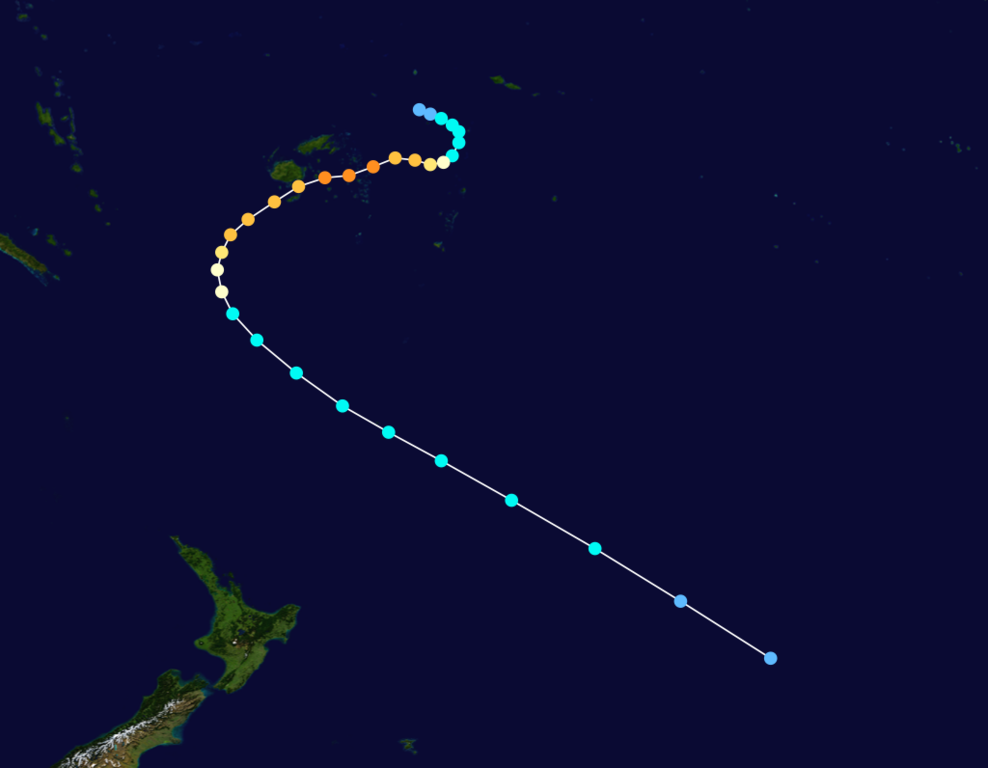
| current | 05:29, 9 August 2009 | | 1,024 × 796 (98 KB) | commons>Cyclonebiskit | {{Information |Description={{en|Track map of Cyclone Meli of the 1978-79 South Pacific cyclone season. The points show the location of the storm at 6-hour intervals. The colour represents the storm's [[:w:maximum sustained wind|maximum sustained wind spee |
File usage
There are no pages that use this file.