File:McCurtainCounty1909.jpg
Jump to navigation
Jump to search
Size of this preview: 423 × 600 pixels. Other resolutions: 169 × 240 pixels | 478 × 678 pixels.
Original file (478 × 678 pixels, file size: 111 KB, MIME type: image/jpeg)
Summary
| Description |
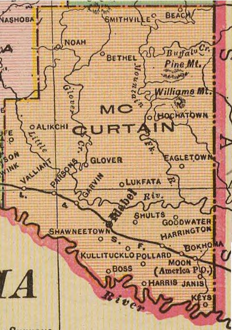
English: 1909 map of McCurtain County, Oklahoma. |
| Date | |
| Source | Oklahoma from the latest state and federal transportation surveys. Geo. F. Cram, Chicago and New York. (1909) |
| Author | Cram, George Franklin/Davis, Ellis Arthur |
Licensing
This media file is in the public domain in the United States. This applies to U.S. works where the copyright has expired, often because its first publication occurred prior to January 1, 1929, and if not then due to lack of notice or renewal. See this page for further explanation.
|
 | |
 |
This image might not be in the public domain outside of the United States; this especially applies in the countries and areas that do not apply the rule of the shorter term for US works, such as Canada, Mainland China (not Hong Kong or Macao), Germany, Mexico, and Switzerland. The creator and year of publication are essential information and must be provided. See Wikipedia:Public domain and Wikipedia:Copyrights for more details.
|
File history
Click on a date/time to view the file as it appeared at that time.
| Date/Time | Thumbnail | Dimensions | User | Comment | |
|---|---|---|---|---|---|
| current | 02:31, 29 January 2010 | | 478 × 678 (111 KB) | commons>Narthring | {{Information |Description={{en|1=1909 map of McCurtain County, Oklahoma.}} |Source=Oklahoma from the latest state and federal transportation surveys. Geo. F. Cram, Chicago and New York. (1909) |Author=Cram, George Franklin/Davis, Ellis Arthur |Date=1909 |
File usage
There are no pages that use this file.