File:Markham-suburbs aerial-edit2.jpg
Jump to navigation
Jump to search

Size of this preview: 800 × 596 pixels. Other resolutions: 320 × 238 pixels | 640 × 477 pixels | 1,024 × 763 pixels | 1,280 × 954 pixels | 2,000 × 1,490 pixels.
Original file (2,000 × 1,490 pixels, file size: 1.01 MB, MIME type: image/jpeg)
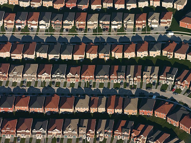
This image was selected as picture of the day on Wikimedia Commons for 29 November 2008. It was captioned as follows: English: An aerial view of housing developments near Markham, Ontario Photo by IDuke, November 2005. Other languages:
Dansk: Luftfoto af bebyggelse nær Markham, Ontario. Foto af IDuke, november 2005. Deutsch: Luftaufnahme einer Wohnsiedlung in Markham (Ontario) English: An aerial view of housing developments near Markham, Ontario Photo by IDuke, November 2005. Français : Vue aérienne des lotissements près de Markham en Ontario en novembre 2005 Română: Fotografie din aer a unei zone rezidențiale de lângă Markham, Ontario. Fotografie de IDuke, noiembrie 2005. Русский: Пригород Маркхэма (Онтарио) с высоты птичьего полёта. 한국어: Markham, Ontario 지방의 항공 사진 中文: 万锦附近的房屋航拍图 中文(繁體): 加拿大萬錦附近的房屋航拍圖 |
|
Summary
| Description |
English: An aerial view of housing developments near Markham, Ontario Photo by IDuke, November 2005.
Français : Vue aérienne des lotissements près de Markham en Ontario en Novembre 2005 |
| Date | November 2005 (12 November 2005, according to Exif data) |
| Source | Edited version (sharpness, contrast and saturation) of File:Markham-suburbs_id.jpg |
| Author | IDuke (this edited version: Sting) |
| Camera location | | View this and other nearby images on: OpenStreetMap |
|---|
Licensing
This file is licensed under the Creative Commons Attribution-Share Alike 2.5 Generic license.
- You are free:
- to share – to copy, distribute and transmit the work
- to remix – to adapt the work
- Under the following conditions:
- attribution – You must give appropriate credit, provide a link to the license, and indicate if changes were made. You may do so in any reasonable manner, but not in any way that suggests the licensor endorses you or your use.
- share alike – If you remix, transform, or build upon the material, you must distribute your contributions under the same or compatible license as the original.
File history
Click on a date/time to view the file as it appeared at that time.
| Date/Time | Thumbnail | Dimensions | User | Comment | |
|---|---|---|---|---|---|
| current | 12:11, 20 October 2007 | | 2,000 × 1,490 (1.01 MB) | commons>Sting | Slightly less saturated ; blur in the lower right corner fixed |
File usage
There are no pages that use this file.