File:Mariazellerbahn map1.png
Jump to navigation
Jump to search
Size of this preview: 268 × 599 pixels. Other resolutions: 107 × 240 pixels | 215 × 480 pixels | 344 × 768 pixels | 458 × 1,024 pixels | 1,320 × 2,948 pixels.
Original file (1,320 × 2,948 pixels, file size: 241 KB, MIME type: image/png)
File history
Click on a date/time to view the file as it appeared at that time.
| Date/Time | Thumbnail | Dimensions | User | Comment | |
|---|---|---|---|---|---|
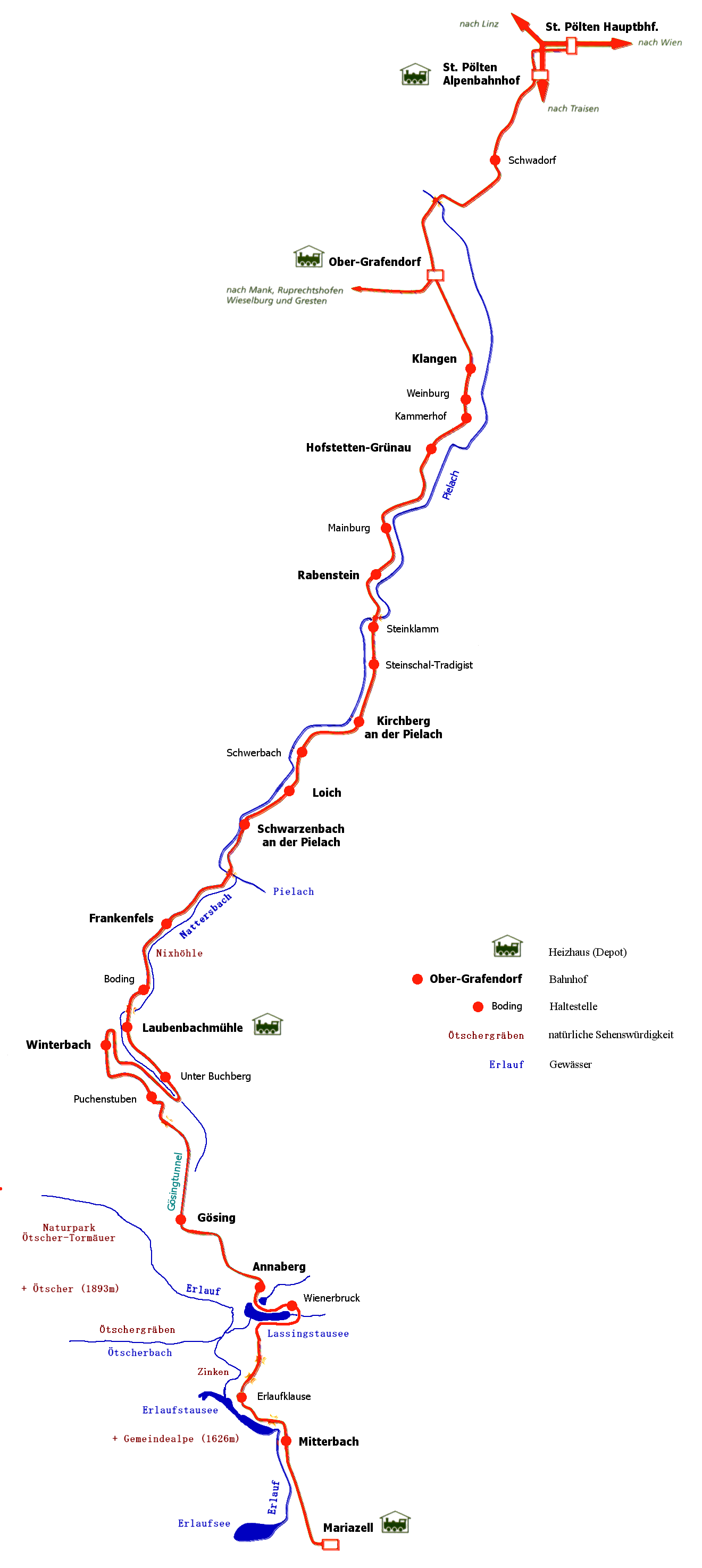
| current | 19:57, 19 July 2005 | | 1,320 × 2,948 (241 KB) | commons>Herbert Ortner | * Description: Route map of the Mariazellerbahn in Austria/Beschreibung: Streckenkarte der Mariazellerbahn in Österreich * drawing based on route map by the [http://www.mariazellerbahn.at Friends of the Ma |
File usage
There are no pages that use this file.