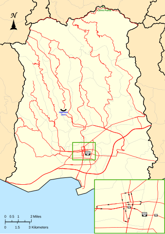
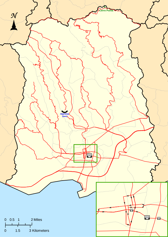
File:Mapa de la carretera PR-133 en Ponce, Puerto Rico (M133).svg
Jump to navigation
Jump to search

Size of this PNG preview of this SVG file: 424 × 599 pixels. Other resolutions: 170 × 240 pixels | 339 × 480 pixels | 543 × 768 pixels | 724 × 1,024 pixels | 1,449 × 2,048 pixels | 585 × 827 pixels.
Original file (SVG file, nominally 585 × 827 pixels, file size: 780 KB)
.svg)
File history
Click on a date/time to view the file as it appeared at that time.
| Date/Time | Thumbnail | Dimensions | User | Comment | |
|---|---|---|---|---|---|
| current | 03:43, 7 November 2018 | | 585 × 827 (780 KB) | commons>Mercy11 | Removed the road shield for PR-132 in the inset, which didn't belong there because this map is to show the route for PR-133 only. |
File usage
There are no pages that use this file.
.svg)