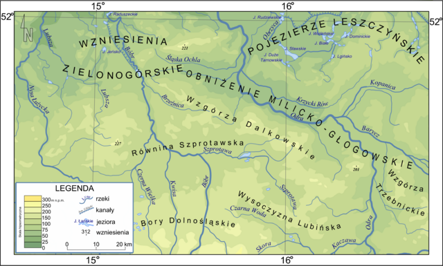
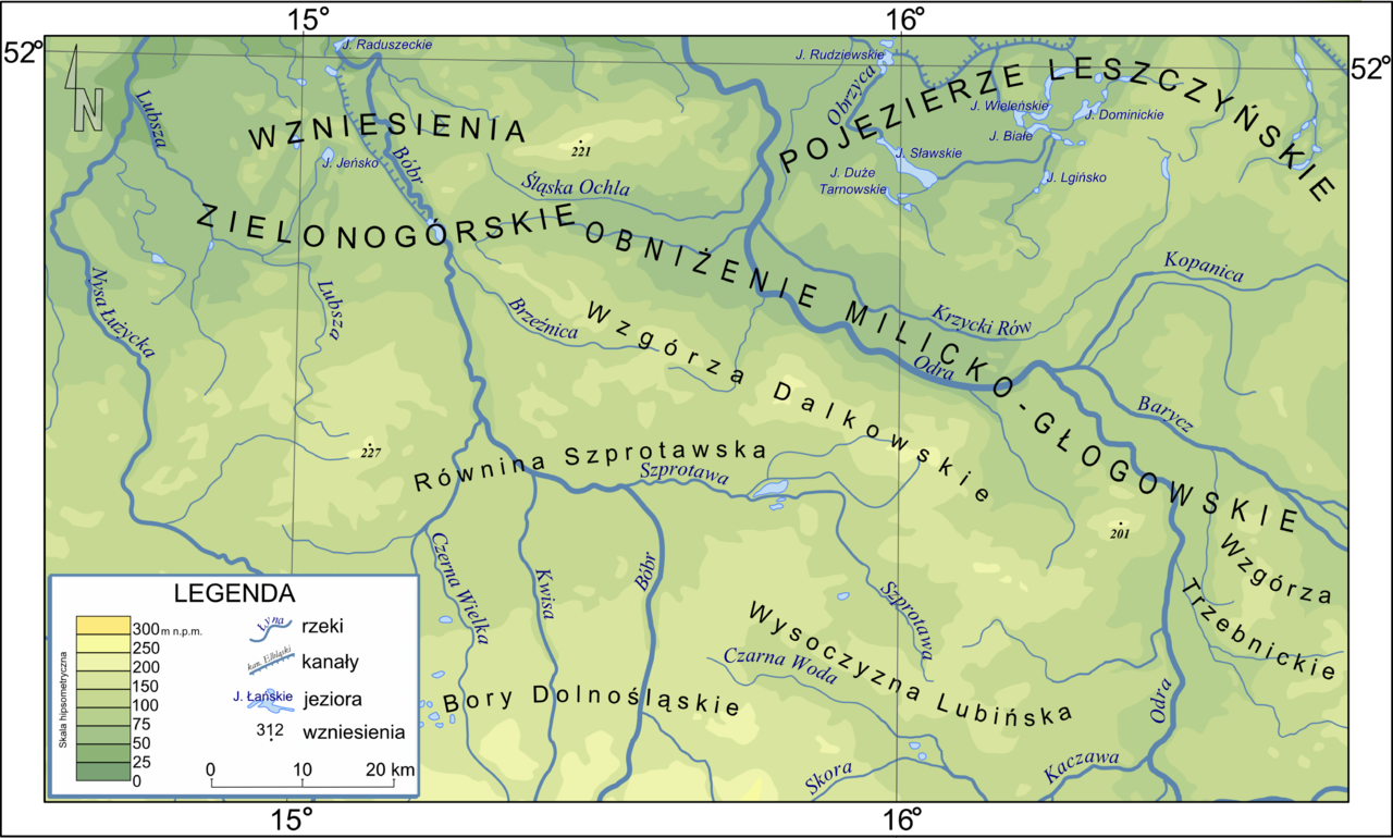
File:Mapa części Niziny Śląsko Łużyckiej i Wału Trzebnickiego.png
Jump to navigation
Jump to search

Size of this preview: 800 × 482 pixels. Other resolutions: 320 × 193 pixels | 640 × 385 pixels | 1,024 × 616 pixels | 1,280 × 770 pixels | 2,560 × 1,541 pixels | 3,665 × 2,206 pixels.
Original file (3,665 × 2,206 pixels, file size: 1.69 MB, MIME type: image/png)
File history
Click on a date/time to view the file as it appeared at that time.
| Date/Time | Thumbnail | Dimensions | User | Comment | |
|---|---|---|---|---|---|
| current | 20:49, 27 September 2010 | | 3,665 × 2,206 (1.69 MB) | commons>Masur | typos |
File usage
There are no pages that use this file.