File:Mapa bases antarticas brasil.png
Jump to navigation
Jump to search
Size of this preview: 800 × 494 pixels. Other resolutions: 320 × 198 pixels | 640 × 395 pixels | 903 × 558 pixels.
Original file (903 × 558 pixels, file size: 83 KB, MIME type: image/png)
File history
Click on a date/time to view the file as it appeared at that time.
| Date/Time | Thumbnail | Dimensions | User | Comment | |
|---|---|---|---|---|---|
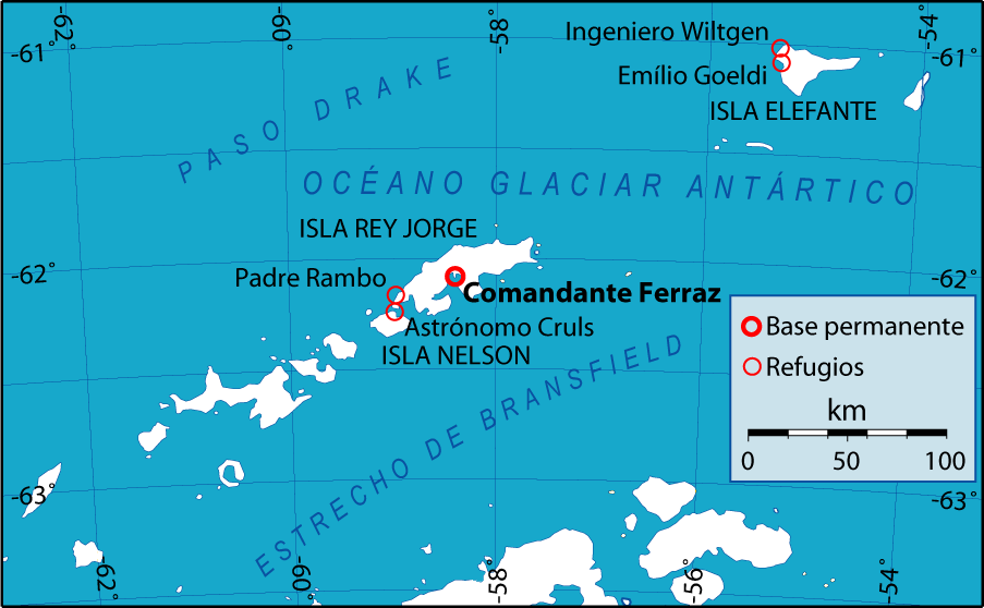
| current | 23:52, 17 December 2006 | | 903 × 558 (83 KB) | commons>Gi | {{Information |Description= Mapa de ubicación de la base y refugios antárticos de Brasil en las Islas Shetland del Sur. Location map of antarctic station and refugees of Brazil in South Shetland Islands, spanish language. |Source= Own work over an OMC f |
File usage
There are no pages that use this file.