File:Map showing the Départements of Algeria from 1962-1968 and 1968-1974.svg
Jump to navigation
Jump to search

Size of this PNG preview of this SVG file: 424 × 600 pixels. Other resolutions: 170 × 240 pixels | 339 × 480 pixels | 543 × 768 pixels | 724 × 1,024 pixels | 1,448 × 2,048 pixels | 744 × 1,052 pixels.
Original file (SVG file, nominally 744 × 1,052 pixels, file size: 77 KB)
File history
Click on a date/time to view the file as it appeared at that time.
| Date/Time | Thumbnail | Dimensions | User | Comment | |
|---|---|---|---|---|---|
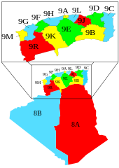
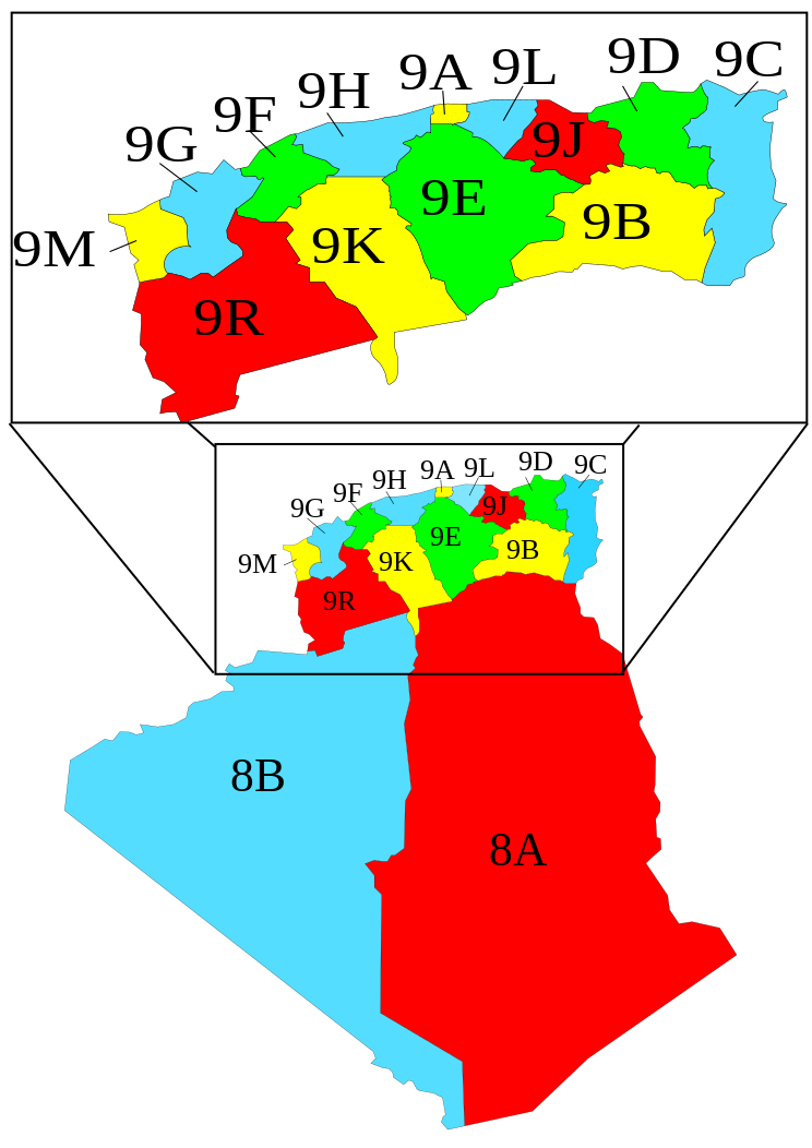
| current | 11:02, 7 November 2007 | | 744 × 1,052 (77 KB) | commons>Escondites | == Summary == {{Information |Description= A map showing the Départements, Algeria from 1962-1968 and 1968-1974 when they where called "provinces". |Source= Image:Algeria_elections_91_by_province.svg by {{u|Ch |
File usage
There are no pages that use this file.