File:Map of the Oberämter of the Electoral Palatinate (1789) - Numbered.svg
Jump to navigation
Jump to search

Size of this PNG preview of this SVG file: 800 × 545 pixels. Other resolutions: 320 × 218 pixels | 640 × 436 pixels | 1,024 × 698 pixels | 1,280 × 873 pixels | 2,560 × 1,745 pixels | 3,770 × 2,570 pixels.
Original file (SVG file, nominally 3,770 × 2,570 pixels, file size: 532 KB)
_-_Numbered.svg)
File history
Click on a date/time to view the file as it appeared at that time.
| Date/Time | Thumbnail | Dimensions | User | Comment | |
|---|---|---|---|---|---|
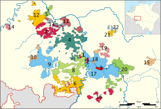
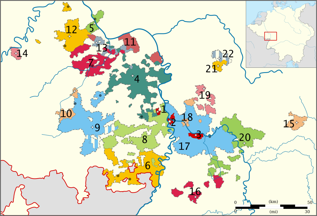
| current | 14:41, 12 November 2010 | | 3,770 × 2,570 (532 KB) | commons>Sir Iain | {{Information |Description={{en|1=Map of the Political subdivisions (''Oberämter'') of the Electoral Palatinate in 1789.}} |Source={{own}}, based on a map from [http://www.uni-heidelberg.de/fakultaeten/philosophie/zegk/fpi/karte.html the Heidelberg Unive |
File usage
There are no pages that use this file.
_-_Numbered.svg)