File:Map of the Gupta Empire circa 420 CE.png
Jump to navigation
Jump to search

Size of this preview: 800 × 461 pixels. Other resolutions: 320 × 184 pixels | 640 × 368 pixels | 1,024 × 590 pixels | 1,280 × 737 pixels | 3,196 × 1,840 pixels.
Original file (3,196 × 1,840 pixels, file size: 13.33 MB, MIME type: image/png)
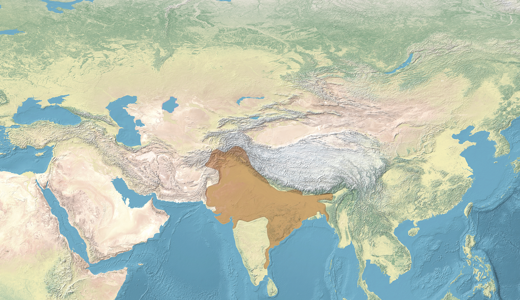
Summary
| Description |
English: Map of the Gupta Empire circa 420 CE |
| Date | |
| Source | |
| Author | naturalearthdata.com, offered to the Public Domain per Terms of Use |

Licensing
| This file is made available under the Creative Commons CC0 1.0 Universal Public Domain Dedication. | |
| The person who associated a work with this deed has dedicated the work to the public domain by waiving all of their rights to the work worldwide under copyright law, including all related and neighboring rights, to the extent allowed by law. You can copy, modify, distribute and perform the work, even for commercial purposes, all without asking permission.
|
File history
Click on a date/time to view the file as it appeared at that time.
| Date/Time | Thumbnail | Dimensions | User | Comment | |
|---|---|---|---|---|---|
| current | 15:51, 21 February 2023 | | 3,196 × 1,840 (13.33 MB) | commons>पाटलिपुत्र | cropped |
File usage
There are no pages that use this file.