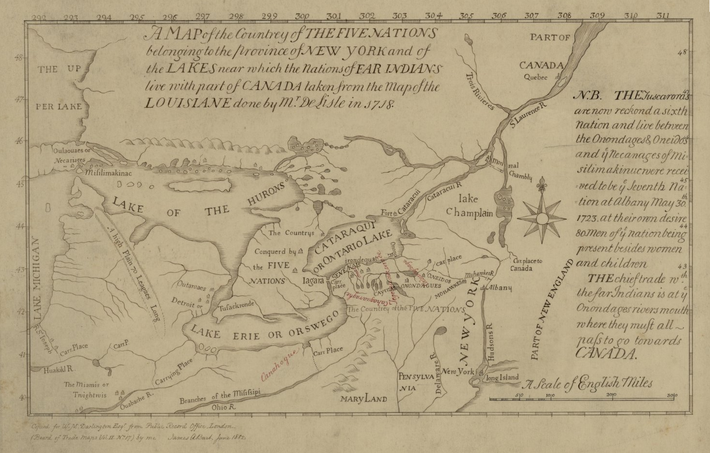
File:Map of the Country of the Five Nations belonging to the province of New York and of the Lakes near which the Nations of Far Indians live with part of Canada taken from the Map of the Louisiane done 1730.png
Jump to navigation
Jump to search
Size of this preview: 800 × 510 pixels. Other resolutions: 320 × 204 pixels | 640 × 408 pixels | 1,024 × 653 pixels | 1,451 × 925 pixels.
Original file (1,451 × 925 pixels, file size: 1.52 MB, MIME type: image/png)
File history
Click on a date/time to view the file as it appeared at that time.
| Date/Time | Thumbnail | Dimensions | User | Comment | |
|---|---|---|---|---|---|
| current | 15:40, 16 June 2021 | | 1,451 × 925 (1.52 MB) | commons>Psiĥedelisto | (Slightly) higher quality version from same source. |
File usage
There are no pages that use this file.