File:Map of the British and French dominions in North America, drawn by order of the British government in 1755, showing what that government then conceded as New England (9138601070).jpg
Jump to navigation
Jump to search
Size of this preview: 600 × 599 pixels. Other resolutions: 240 × 240 pixels | 481 × 480 pixels | 769 × 768 pixels | 1,025 × 1,024 pixels | 2,050 × 2,048 pixels | 3,623 × 3,619 pixels.
Original file (3,623 × 3,619 pixels, file size: 11.93 MB, MIME type: image/jpeg)
.jpg)
Summary
| Description |
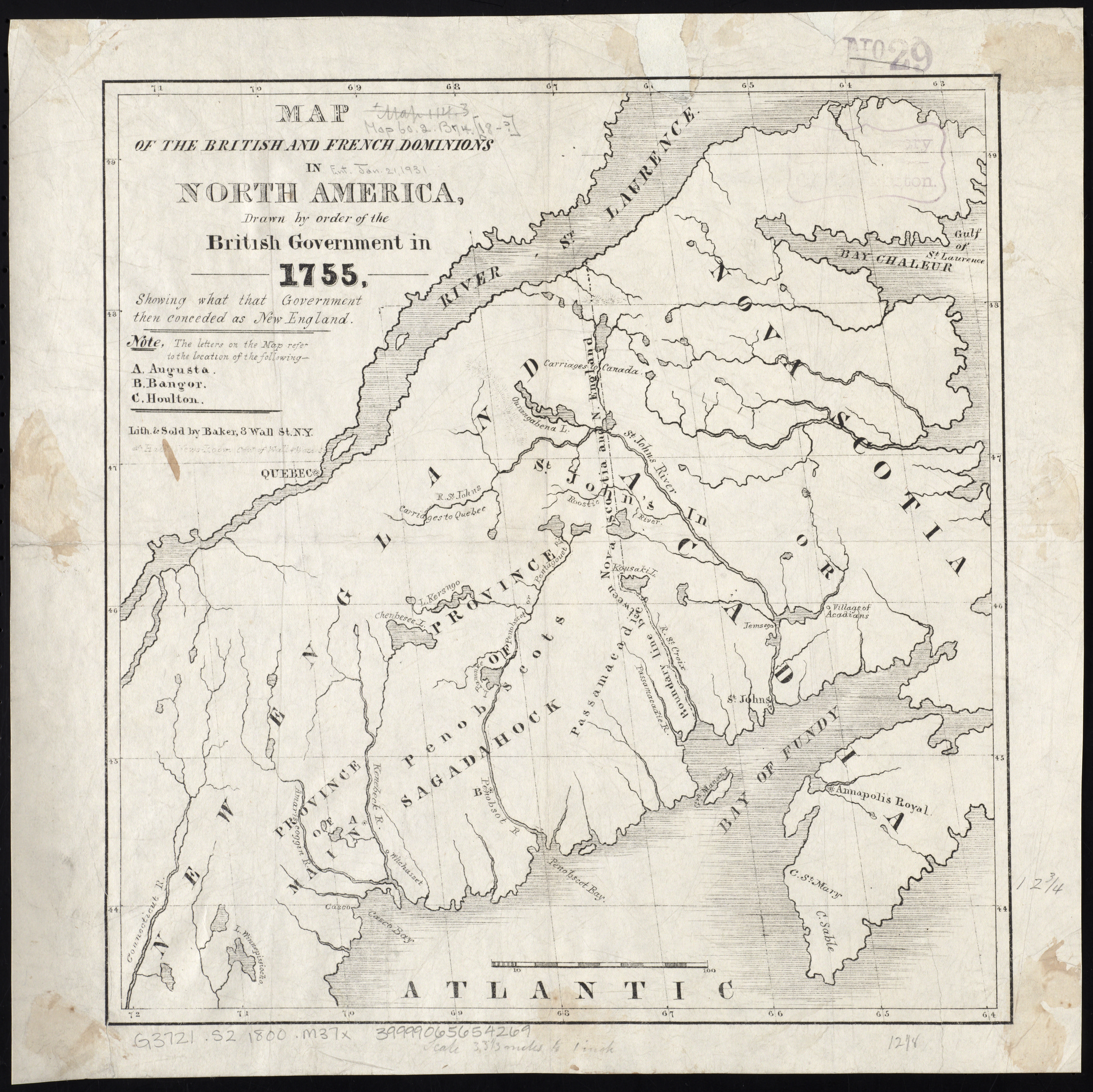
Zoom into this map at maps.bpl.org. Publisher: Baker Date: 1800 Location: New England Dimensions: 33 x 31 cm. Scale: Scale [ca. 1:2,100,000] Call Number: G3721.S2 1800 .M37x |
| Date | |
| Source |
|
| Author | http://maps.bpl.org |
Licensing
This file is licensed under the Creative Commons Attribution 2.0 Generic license.
- You are free:
- to share – to copy, distribute and transmit the work
- to remix – to adapt the work
- Under the following conditions:
- attribution – You must give appropriate credit, provide a link to the license, and indicate if changes were made. You may do so in any reasonable manner, but not in any way that suggests the licensor endorses you or your use.
| This image, originally posted to Flickr, was reviewed on 21 August 2013 by the administrator or reviewer File Upload Bot (Magnus Manske), who confirmed that it was available on Flickr under the stated license on that date. |
File history
Click on a date/time to view the file as it appeared at that time.
| Date/Time | Thumbnail | Dimensions | User | Comment | |
|---|---|---|---|---|---|
| current | 01:06, 30 October 2016 | | 3,623 × 3,619 (11.93 MB) | commons>Opencooper | full resolution |
File usage
There are no pages that use this file.
.jpg)