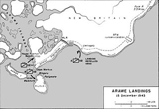
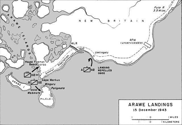
File:Map of the Allied landings at Arawe on 15 December 1943.jpg
Jump to navigation
Jump to search

Size of this preview: 800 × 550 pixels. Other resolutions: 320 × 220 pixels | 640 × 440 pixels | 1,024 × 704 pixels | 1,161 × 798 pixels.
Original file (1,161 × 798 pixels, file size: 162 KB, MIME type: image/jpeg)
File history
Click on a date/time to view the file as it appeared at that time.
| Date/Time | Thumbnail | Dimensions | User | Comment | |
|---|---|---|---|---|---|
| current | 19:16, 20 February 2017 | | 1,161 × 798 (162 KB) | commons>Macesito | Cropped |
File usage
There are no pages that use this file.