File:Map of south essex 1594 John Norden.jpg
Jump to navigation
Jump to search

Size of this preview: 800 × 558 pixels. Other resolutions: 320 × 223 pixels | 640 × 446 pixels | 1,024 × 714 pixels | 1,293 × 902 pixels.
Original file (1,293 × 902 pixels, file size: 899 KB, MIME type: image/jpeg)
File history
Click on a date/time to view the file as it appeared at that time.
| Date/Time | Thumbnail | Dimensions | User | Comment | |
|---|---|---|---|---|---|
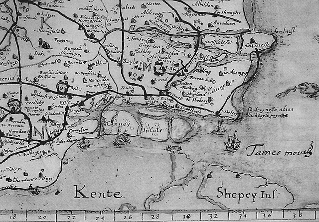
| current | 11:29, 3 June 2008 | | 1,293 × 902 (899 KB) | commons>Oneblackline | {{Information |Description={{en|1=Image of John Norden's map of south east essex in 1594. The map shows the geographical status of the Canvey group of islands before the unifying reclamation project of 1622.}} |Source=John Norden. (1594). Speculi Brinanni |
File usage
There are no pages that use this file.