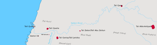
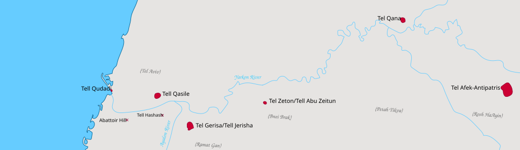
File:Map of main archaeological sites along the Yarkon River.svg
Jump to navigation
Jump to search

Size of this PNG preview of this SVG file: 512 × 148 pixels. Other resolutions: 320 × 93 pixels | 640 × 185 pixels | 1,024 × 296 pixels | 1,280 × 370 pixels | 2,560 × 740 pixels.
Original file (SVG file, nominally 512 × 148 pixels, file size: 1.03 MB)
File history
Click on a date/time to view the file as it appeared at that time.
| Date/Time | Thumbnail | Dimensions | User | Comment | |
|---|---|---|---|---|---|
| current | 10:27, 3 May 2020 | 512 × 148 (1.03 MB) | commons>Bolter21 | add more labels |
File usage
There are no pages that use this file.