File:Map of US 66.svg
Jump to navigation
Jump to search

Size of this PNG preview of this SVG file: 800 × 492 pixels. Other resolutions: 320 × 197 pixels | 640 × 394 pixels | 1,024 × 630 pixels | 1,280 × 788 pixels | 2,560 × 1,575 pixels | 1,500 × 923 pixels.
Original file (SVG file, nominally 1,500 × 923 pixels, file size: 2.02 MB)
File history
Click on a date/time to view the file as it appeared at that time.
| Date/Time | Thumbnail | Dimensions | User | Comment | |
|---|---|---|---|---|---|
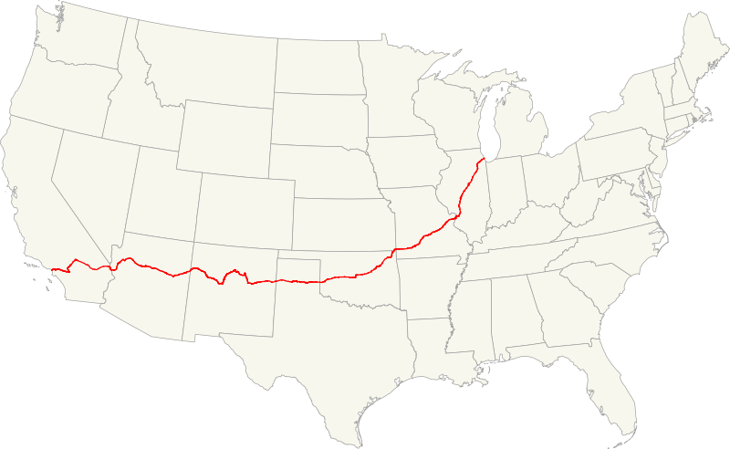
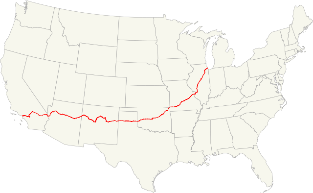
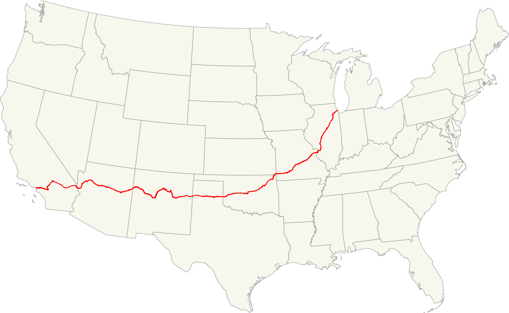
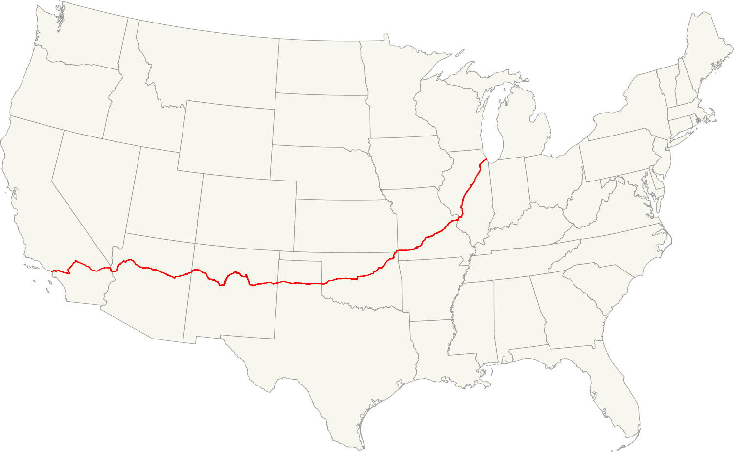
| current | 19:09, 30 December 2010 | | 1,500 × 923 (2.02 MB) | commons>Fredddie | {{Information |Description=Map of former U.S. Route 66.{{QGIS}}{{Inkscape}} |Source=[http://www.census.gov/geo/cob/bdy/st/st00shp/st99_d00_shp.zip USA map](GIS data), [http://www.fhwa.dot.gov/planning/nhpn/2005/nhpn2005_08.zip roads] (GIS data), [http://w |
File usage
There are no pages that use this file.