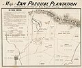
File:Map of Rancho San Pascual by real estate developers circa 1870 HUNTINGTON Museum Los Angeles.jpg
Jump to navigation
Jump to search

Size of this preview: 723 × 600 pixels. Other resolutions: 289 × 240 pixels | 579 × 480 pixels | 926 × 768 pixels | 1,234 × 1,024 pixels | 2,469 × 2,048 pixels | 4,888 × 4,055 pixels.
Original file (4,888 × 4,055 pixels, file size: 5.54 MB, MIME type: image/jpeg)
File history
Click on a date/time to view the file as it appeared at that time.
| Date/Time | Thumbnail | Dimensions | User | Comment | |
|---|---|---|---|---|---|
| current | 07:03, 28 March 2023 |  | 4,888 × 4,055 (5.54 MB) | commons>Jengod | Uploaded a work by San Pascual Plantation developers from Title Map of the San Pasqual Plantation : also showing portion of Los Angeles County, California. Creator Baker, Geo. H. (George Holbrook), 1827-1906 Date Searchable 1870 Date 1870 Call Number 255611 Physical Description 1 map ; 34 x 45 cm., sheet 41 x 58 cm. Scale Scale none given Coordinates W 118°/N 34° approx. Location depicted North America United States California Los Angeles (County) San Gabriel Valley Place of creation San Fran... |
File usage
There are no pages that use this file.