File:Map of Port Arthur.png
Jump to navigation
Jump to search

Size of this preview: 558 × 600 pixels. Other resolutions: 223 × 240 pixels | 447 × 480 pixels | 715 × 768 pixels | 1,084 × 1,165 pixels.
Original file (1,084 × 1,165 pixels, file size: 264 KB, MIME type: image/png)
File history
Click on a date/time to view the file as it appeared at that time.
| Date/Time | Thumbnail | Dimensions | User | Comment | |
|---|---|---|---|---|---|
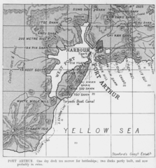
| current | 06:07, 30 April 2006 | | 1,084 × 1,165 (264 KB) | commons>Ideru~commonswiki | Map of Port Arthur from ''JANE'S FIGHTING SHIPS 1906-07'', Edited by Fred T. Jane, Published by Sampson Low, Marston, 1906 Modified by user:Ideru {{PDold}} |
File usage
There are no pages that use this file.