File:Map of Pontus.jpg
Jump to navigation
Jump to search

Size of this preview: 800 × 516 pixels. Other resolutions: 320 × 206 pixels | 640 × 413 pixels | 1,024 × 661 pixels | 1,280 × 826 pixels | 2,560 × 1,652 pixels | 3,289 × 2,122 pixels.
Original file (3,289 × 2,122 pixels, file size: 1.03 MB, MIME type: image/jpeg)
File history
Click on a date/time to view the file as it appeared at that time.
| Date/Time | Thumbnail | Dimensions | User | Comment | |
|---|---|---|---|---|---|
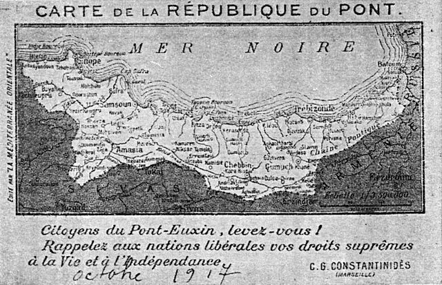
| current | 20:01, 21 May 2008 | | 3,289 × 2,122 (1.03 MB) | commons>Andrew Dalby | {{Information |Description=Postcard map of the projected Republic of the Pontus, 1917 |Source=E. Pavlidis, Pos kai diati ... 1956 |Date=1917 |Author=unknown artist |Permission=PD old |other_versions= }} |
File usage
There are no pages that use this file.